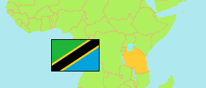
Itigi
District in Central Tanzania
Contents: Subdivision
The population in Itigi as well as related information and services (Wikipedia, Google, images).
| Name | Status | Population Census 2022-08-23 | |
|---|---|---|---|
| Itigi (← Manyoni) | District | 215,947 | |
| Aghondi | Rural Ward | 10,059 | → |
| Idodyandole | Rural Ward | 19,722 | → |
| Ipande | Rural Ward | 19,017 | → |
| Itigi Majengo | Mixed Ward | 12,216 | → |
| Itigi Mjini | Mixed Ward | 7,157 | → |
| Kalangali | Mixed Ward | 9,081 | → |
| Kitaraka | Rural Ward | 26,950 | → |
| Mgandu | Rural Ward | 26,887 | → |
| Mitundu | Mixed Ward | 32,370 | → |
| Mwamagembe | Rural Ward | 18,114 | → |
| Rungwa | Rural Ward | 9,669 | → |
| Rungwa Game Reserve / Kizigo Game Reserve | Game Reserve | ... | → |
| Sanjaranda | Rural Ward | 12,560 | → |
| Tambukareli | Mixed Ward | 12,145 | → |
| Central | Zone | 8,485,362 |
Source: National Bureau of Statistics Tanzania.
Explanation: Area figures are derived from geospatial data.