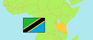
Iramba
District in Central Tanzania
Contents: Subdivision
The population in Iramba as well as related information and services (Wikipedia, Google, images).
| Name | Status | Population Census 2022-08-23 | |
|---|---|---|---|
| Iramba | District | 328,912 | |
| Kaselya | Rural Ward | 12,876 | → |
| Kidaru | Rural Ward | 15,321 | → |
| Kinampanda | Rural Ward | 11,030 | → |
| Kiomboi | Mixed Ward | 17,350 | → |
| Kisiriri | Rural Ward | 12,487 | → |
| Kyengege | Rural Ward | 11,305 | → |
| Maluga | Rural Ward | 8,857 | → |
| Mbelekese | Rural Ward | 17,564 | → |
| Mgongo | Rural Ward | 19,658 | → |
| Mtekente | Rural Ward | 25,693 | → |
| Mtoa | Rural Ward | 25,902 | → |
| Mukulu | Rural Ward | 7,392 | → |
| Ndago | Mixed Ward | 20,241 | → |
| Ndulungu | Rural Ward | 14,496 | → |
| Ntwike | Rural Ward | 24,629 | → |
| Old-Kiomboi | Mixed Ward | 13,323 | → |
| Shelui | Mixed Ward | 22,021 | → |
| Tulya | Rural Ward | 8,348 | → |
| Ulemo | Mixed Ward | 16,056 | → |
| Urughu | Rural Ward | 24,363 | → |
| Central | Zone | 8,485,362 |
Source: National Bureau of Statistics Tanzania.
Explanation: Area figures are derived from geospatial data.