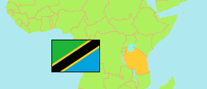
Kagera
Region in Tanzania
Contents: Subdivision
The population development in Kagera as well as related information and services (Wikipedia, Google, images).
| Name | Status | Population Census 1988-08-27 | Population Census 2002-08-01 | Population Census 2012-08-26 | Population Census 2022-08-23 | |
|---|---|---|---|---|---|---|
| Kagera | Region | ... | 1,791,451 | 2,458,023 | 2,989,299 | |
| Biharamulo | District | ... | ... | 323,486 | 457,114 | → |
| Bukoba Municipal | Municipality | 46,503 | 80,868 | 128,796 | 144,938 | → |
| Bukoba Rural | District | ... | ... | 289,697 | 322,448 | → |
| Karagwe | District | ... | ... | 332,020 | 385,744 | → |
| Kyerwa | District | ... | ... | 321,026 | 412,910 | → |
| Missenyi | District | ... | ... | 202,632 | 245,394 | → |
| Muleba | District | 273,329 | 385,184 | 540,310 | 637,659 | → |
| Ngara | District | ... | ... | 320,056 | 383,092 | → |
| Tanzania | United Republic | 23,174,336 | 34,443,603 | 44,928,923 | 61,741,120 |
Source: National Bureau of Statistics Tanzania.
Explanation: Area figures of districts are calculated from geospatial data.
Further information about the population structure:
| Gender (C 2022) | |
|---|---|
| Males | 1,459,280 |
| Females | 1,530,019 |
| Urbanization (C 2022) | |
|---|---|
| Rural | 2,655,043 |
| Urban | 334,256 |
| Age Groups (C 2022) | |
|---|---|
| 0-14 years | 1,357,969 |
| 15-64 years | 1,528,747 |
| 65+ years | 102,583 |
| Age Distribution (C 2022) | |
|---|---|
| 80+ years | 26,539 |
| 70-79 years | 42,287 |
| 60-69 years | 88,476 |
| 50-59 years | 148,736 |
| 40-49 years | 243,355 |
| 30-39 years | 319,026 |
| 20-29 years | 451,108 |
| 10-19 years | 743,257 |
| 0-9 years | 926,515 |