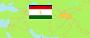
Suġd
Province in Tajikistan
Contents: Subdivision
The population development in Suġd as well as related information and services (Wikipedia, Google, images).
| Name | Status | Native | Population Census 1979-01-12 | Population Census 1989-01-12 | Population Census 2000-01-20 | Population Census 2010-09-21 | Population Census 2020-10-01 | Population Estimate 2022-01-01 | |
|---|---|---|---|---|---|---|---|---|---|
| Suġd [Sughd] | Province | Суғд | 1,194,683 | 1,558,158 | 1,871,979 | 2,233,550 | 2,769,261 | 2,823,900 | |
| Ajnī [Ayni] | District | Айнӣ | 43,840 | 53,367 | 64,690 | 72,054 | 90,048 | 91,200 | → |
| Ašt [Asht] | District | Ашт | 58,680 | 82,623 | 111,576 | 135,185 | 172,340 | 176,300 | → |
| Boboçon Ġafurov [Ghafurov; incl. Istiḳlol] | District | Бобоҷон Ғафуров | 161,329 | 209,401 | 269,607 | 330,061 | 400,065 | 407,300 | → |
| Būston [Čkalov] | City | Бӯстон | 47,655 | 57,075 | 24,702 | 28,190 | 37,007 | 38,400 | → |
| Çabbor Rasulov [Jabbor Rasulov] | District | Ҷаббор Расулов | 61,239 | 80,599 | 97,553 | 113,229 | 141,240 | 144,100 | → |
| Chuçand [Khujand] | City | Хуҷанд | 130,353 | 160,458 | 147,061 | 162,825 | 196,427 | 198,700 | → |
| Devaštič [Ġončī, Devashtich] | District | Деваштич | 60,608 | 82,689 | 112,037 | 138,618 | 177,760 | 182,100 | → |
| Guliston [Ḳajroqqum] | City | Гулистон | 40,381 | 41,433 | 35,405 | 40,364 | 49,649 | 50,200 | → |
| Isfara | City | Исфара | 121,528 | 156,387 | 197,112 | 230,803 | 281,166 | 285,000 | → |
| Istaravšan [Istaravshan] | City | Истаравшан | 118,069 | 159,060 | 178,885 | 222,230 | 281,918 | 288,100 | → |
| Konibodom | City | Конибодом | 102,533 | 128,148 | 159,156 | 181,110 | 217,330 | 219,900 | → |
| Kūh̦istoni Mastčoh̦ [Kuhistoni Mastchoh] | District | Кӯҳистони Мастчоҳ | ... | ... | 16,490 | 21,095 | 23,935 | 24,400 | → |
| Mastčoh̦ [Mastchoh] | District | Мастчоҳ | 56,082 | 80,716 | 84,689 | 101,313 | 128,791 | 132,500 | → |
| Pançakent [Panjakent] | City | Панҷакент | 106,993 | 146,310 | 199,651 | 245,644 | 304,818 | 312,400 | → |
| Šah̦riston [Shahriston] | District | Шаҳристон | ... | ... | 27,821 | 34,631 | 44,830 | 46,200 | → |
| Spitamen | District | Спитамен | 58,240 | 78,614 | 97,226 | 116,016 | 146,493 | 149,700 | → |
| Zafarobod | District | Зафаробод | 27,153 | 41,278 | 48,318 | 60,182 | 75,444 | 77,400 | → |
| Toçikiston [Tajikistan] | Republic | Тоҷикистон | 3,801,357 | 5,108,576 | 6,127,493 | 7,564,502 | 9,657,005 | 9,886,800 |
Source: State Statistical Committee of the Republic of Tajikistan.
Explanation: In 2020, Dushanbe city was expanded by areas of Rūdakī district with about 77 km² and 230,000 inhabitants. The figures before 2020 do not take this change into account.