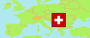
Wahlkreis Toggenburg
District in St. Gallen
District
The population development of Wahlkreis Toggenburg.
| Name | Status | Population Census 1980-12-02 | Population Census 1990-12-04 | Population Census 2000-12-05 | Population Estimate 2010-12-31 | Population Estimate 2020-12-31 | Population Estimate 2023-12-31 | |
|---|---|---|---|---|---|---|---|---|
| Wahlkreis Toggenburg | District | 40,784 | 44,019 | 45,907 | 45,056 | 46,954 | 48,781 | → |
| St. Gallen | Canton | 391,995 | 427,501 | 452,837 | 478,907 | 514,504 | 535,047 |
Contents: Cities and Communes
The population development of the cities and communes in Wahlkreis Toggenburg.
| Name | Status | District | Population Census 1980-12-02 | Population Census 1990-12-04 | Population Census 2000-12-05 | Population Estimate 2010-12-31 | Population Estimate 2020-12-31 | Population Estimate 2023-12-31 | |
|---|---|---|---|---|---|---|---|---|---|
| Bütschwil-Ganterschwil | Commune | Wahlkreis Toggenburg | 4,333 | 4,743 | 4,661 | 4,611 | 5,041 | 5,201 | → |
| Ebnat-Kappel | Commune | Wahlkreis Toggenburg | 4,950 | 5,057 | 5,007 | 4,916 | 5,007 | 5,090 | → |
| Kirchberg (SG) | Commune | Wahlkreis Toggenburg | 6,398 | 7,222 | 7,904 | 8,149 | 9,241 | 9,750 | → |
| Lichtensteig | City | Wahlkreis Toggenburg | 1,998 | 2,046 | 1,893 | 1,924 | 1,879 | 2,079 | → |
| Lütisburg | Commune | Wahlkreis Toggenburg | 1,210 | 1,357 | 1,395 | 1,394 | 1,614 | 1,645 | → |
| Mosnang | Commune | Wahlkreis Toggenburg | 2,280 | 2,515 | 2,894 | 2,881 | 2,889 | 2,969 | → |
| Neckertal (incl. Hemberg, Mogelsberg, Oberhelfenschwil, St. Peterzell) | Commune | Wahlkreis Toggenburg | 5,261 | 6,386 | 6,834 | 6,413 | 6,214 | 6,437 | → |
| Nesslau (incl. Krummenau) | Commune | Wahlkreis Toggenburg | 3,871 | 3,963 | 4,063 | 3,730 | 3,608 | 3,833 | → |
| Wattwil | Commune | Wahlkreis Toggenburg | 8,114 | 8,274 | 8,543 | 8,385 | 8,837 | 9,160 | → |
| Wildhaus-Alt St. Johann | Commune | Wahlkreis Toggenburg | 2,369 | 2,456 | 2,713 | 2,653 | 2,624 | 2,617 | → |
Source: Swiss Federal Statistical Office.
Explanation: Districts and communes in the boundaries of December 2023. The population figures for 2023 are preliminary.