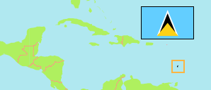
Laborie
District in Places
District
The population development of Laborie.
| Name | Status | Population Census 2010-05-10 | Population Census 2022-05-12 | |
|---|---|---|---|---|
| Laborie | District | 6,701 | 8,507 | → |
| St. Lucia | Country | 166,526 | 166,526 |
Contents: Places
The population development of the places in Laborie.
| Name | Status | District | Population Census 2010-05-10 | Population Census 2022-05-12 | |
|---|---|---|---|---|---|
| Balca | Community | Laborie | 229 | 249 | → |
| Balembouche | Community | Laborie | 79 | 178 | → |
| Banse | Community | Laborie | 262 | 339 | → |
| Banse la Grace | Community | Laborie | 154 | 431 | → |
| Beyar | Community | Laborie | ... | 48 | → |
| Bongalo | Community | Laborie | 3 | 112 | → |
| Daban | Community | Laborie | 169 | 228 | → |
| Fond Berange | Community | Laborie | 139 | 191 | → |
| Gayabois | Community | Laborie | 72 | 62 | → |
| Gentil | Community | Laborie | 107 | 184 | → |
| Getrine | Community | Laborie | 400 | 410 | → |
| Giraud | Community | Laborie | 73 | 145 | → |
| H'Erelle | Community | Laborie | 72 | 136 | → |
| Kennedy Highway | Community | Laborie | 261 | 295 | → |
| Laborie | Village | Laborie | 1,077 | 2,401 | → |
| La Haut | Community | Laborie | 230 | 222 | → |
| La Perle | Community | Laborie | 160 | 190 | → |
| Londonderry | Community | Laborie | 260 | 231 | → |
| Macdomel | Community | Laborie | 58 | 113 | → |
| Morne Gomier | Community | Laborie | 17 | 113 | → |
| Morne le Blanc | Community | Laborie | 18 | 38 | → |
| Morne Paul | Community | Laborie | 13 | 155 | → |
| Olibo | Community | Laborie | 94 | 133 | → |
| Parc Estate | Community | Laborie | 106 | 121 | → |
| Piaye | Community | Laborie | 635 | 796 | → |
| Saltibus | Community | Laborie | 470 | 518 | → |
| Saphire | Community | Laborie | 76 | 109 | → |
Source: The Central Statistical Office of Saint Lucia.