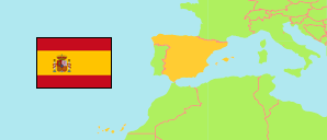
Bande
Municipality in Ourense Province
Municipality
The population development of Bande.
| Name | Status | Population Estimate 2010-01-01 | Population Estimate 2015-01-01 | Population Estimate 2020-01-01 | Population Estimate 2023-01-01 | |
|---|---|---|---|---|---|---|
| Bande | Municipality | 2,083 | 1,735 | 1,498 | 1,478 | → |
| Ourense (Orense) | Province | 335,219 | 318,391 | 306,650 | 304,563 |
Contents: Localities
The population development of the localities in Bande.
| Name | Status | Municipality | Population Estimate 2010-01-01 | Population Estimate 2015-01-01 | Population Estimate 2020-01-01 | Population Estimate 2023-01-01 | |
|---|---|---|---|---|---|---|---|
| Aldea de Arriba | Locality | Bande | 40 | 37 | 34 | 36 | → |
| As Campinas | Locality | Bande | 24 | 21 | 22 | 20 | → |
| Bande | Municipality seat | Bande | 728 | 651 | 619 | 640 | → |
| Corvelle | Locality | Bande | 104 | 79 | 50 | 45 | → |
| Garabelos | Locality | Bande | 30 | 24 | 21 | 28 | → |
| Güín | Locality | Bande | 47 | 45 | 30 | 26 | → |
| Lueda | Locality | Bande | 30 | 28 | 25 | 22 | → |
| Martiñán | Locality | Bande | 73 | 56 | 53 | 52 | → |
| O Viñal | Locality | Bande | 27 | 23 | 24 | 24 | → |
| Pereira | Locality | Bande | 67 | 54 | 46 | 38 | → |
| Recarei | Locality | Bande | 53 | 43 | 35 | 34 | → |
| Ribas | Locality | Bande | 52 | 37 | 33 | 33 | → |
| Santa Comba | Locality | Bande | 96 | 73 | 63 | 62 | → |
| Sarreaus | Locality | Bande | 53 | 43 | 36 | 30 | → |
| Trarigo | Locality | Bande | 39 | 28 | 21 | 27 | → |
| Vilar | Locality | Bande | 39 | 30 | 25 | 22 | → |
Source: Instituto Nacional de Estadística, Madrid.
Explanation: Population of localities according to the municipal register (padrones municipales).