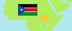
Northern Bahr el Ghazal
State in South Sudan
Contents: Subdivision
The population development in Northern Bahr el Ghazal as well as related information and services (Wikipedia, Google, images).
| Name | Status | Population Census 2008-04-22 | Population Projection 2017-07-01 | |
|---|---|---|---|---|
| Northern Bahr el Ghazal | State | 720,898 | 1,023,383 | |
| Aweil Centre | County | 41,827 | 59,356 | → |
| Aweil East | County | 309,921 | 440,055 | → |
| Aweil North | County | 129,127 | 183,186 | → |
| Aweil South | County | 73,806 | 104,385 | → |
| Aweil West | County | 166,217 | 236,402 | → |
Source: South Sudan National Bureau of Statistics (web).
Explanation: The population projection does not consider migration and displacement since 2008.
Further information about the population structure:
| Gender (C 2008) | |
|---|---|
| Males | 348,290 |
| Females | 372,608 |
| Age Groups (C 2008) | |
|---|---|
| 0-14 years | 343,639 |
| 15-64 years | 351,151 |
| 65+ years | 26,108 |
| Age Distribution (C 2008) | |
|---|---|
| 0-9 years | 261,475 |
| 10-19 years | 143,191 |
| 20-29 years | 110,230 |
| 30-39 years | 83,992 |
| 40-49 years | 53,162 |
| 50-59 years | 31,104 |
| 60-69 years | 37,744 |