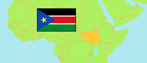
Upper Nile
State in South Sudan
Contents: Subdivision
The population development in Upper Nile as well as related information and services (Wikipedia, Google, images).
| Name | Status | Population Census 2008-04-22 | Population Projection 2017-07-01 | |
|---|---|---|---|---|
| Upper Nile | State | 964,353 | 1,385,478 | |
| Akoka (← Baliet) | County | 9,842 | 14,201 | → |
| Baliet | County | 38,168 | 55,073 | → |
| Fashoda | County | 36,518 | 52,648 | → |
| Longochuk | County | 63,166 | 91,442 | → |
| Luakpiny/Nasir | County | 210,002 | 302,034 | → |
| Maban | County | 45,238 | 65,117 | → |
| Maiwut | County | 79,462 | 113,609 | → |
| Malakal | County | 126,483 | 181,498 | → |
| Manyo | County | 38,010 | 54,034 | → |
| Melut | County | 49,242 | 70,659 | → |
| Panyikang | County | 45,427 | 65,117 | → |
| Renk | County | 137,751 | 198,123 | → |
| Ulang | County | 85,044 | 121,922 | → |
Source: South Sudan National Bureau of Statistics (web).
Explanation: The population projection does not consider migration and displacement since 2008.
Further information about the population structure:
| Gender (C 2008) | |
|---|---|
| Males | 525,430 |
| Females | 438,923 |
| Age Groups (C 2008) | |
|---|---|
| 0-14 years | 428,479 |
| 15-64 years | 509,984 |
| 65+ years | 25,890 |
| Age Distribution (C 2008) | |
|---|---|
| 0-9 years | 302,339 |
| 10-19 years | 229,944 |
| 20-29 years | 159,342 |
| 30-39 years | 119,940 |
| 40-49 years | 73,933 |
| 50-59 years | 38,654 |
| 60-69 years | 40,201 |