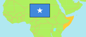
Togdheer
Region in Division
Contents: Subdivision
The population development in Togdheer as well as related information and services (Wikipedia, Google, images).
| Name | Status | Population Estimate 2005-08-01 | Population Estimate 2014-01-01 | Population Projection 2019-01-01 | |
|---|---|---|---|---|---|
| Togdheer | Region | 402,295 | 721,363 | 962,439 | |
| Burco (Burao) | District | 288,211 | 460,354 | 589,975 | → |
| Buuhoodle (Buhoodle) | District | 38,428 | 83,747 | 148,216 | → |
| Oodweyne | District | 42,031 | 101,358 | 133,779 | → |
| Sheekh (Sheikh) | District | 33,625 | 75,904 | 90,469 | → |
| Soomaaliya [Somalia] | Federal Republic | 7,502,654 | 12,316,895 | 15,626,039 |
Source: (2005) UNDP, (2014) Population Estimation Survey 2014 by UN Population Fund, (2019) OCHA Somalia Information Management Working Group (IMWG).
Explanation: The reliability of the tabulated population figures is low. Area figures of districts are calculated by using geospatial data.
Further information about the population structure:
| Status (E 2014) | |
|---|---|
| Rural or Nomadic | 211,879 |
| Urban | 483,724 |
| Internally Displaced (IDP) | 25,760 |