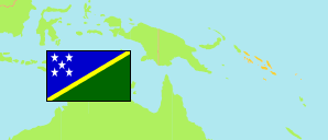
Matangi
Ward in Solomon Islands
Contents: Population
The population development of Matangi as well as related information and services (Wikipedia, Google, images).
| Name | Status | Population Census 1999-11-21 | Population Census 2009-11-23 | Population Census 2019-11-24 | |
|---|---|---|---|---|---|
| Matangi | Ward | 99 | 144 | 214 | |
| Solomon Islands | Sovereign State | 409,042 | 515,870 | 720,956 |
Source: Solomon Islands National Statistical Office.
Further information about the population structure:
| Gender (C 2019) | |
|---|---|
| Males | 122 |
| Females | 92 |
| Age Groups (C 2019) | |
|---|---|
| 0-14 years | 82 |
| 15-64 years | 116 |
| 65+ years | 16 |
| Age Distribution (C 2019) | |
|---|---|
| 80+ years | 5 |
| 70-79 years | 2 |
| 60-69 years | 16 |
| 50-59 years | 20 |
| 40-49 years | 30 |
| 30-39 years | 20 |
| 20-29 years | 30 |
| 10-19 years | 27 |
| 0-9 years | 64 |
| Urbanization (C 2019) | |
|---|---|
| Rural | 214 |
| Religion (C 2019) | |
|---|---|
| South Seas Evangelical Church | 15 |
| Seventh-day Adventist Church | 175 |
| Other religion | 24 |