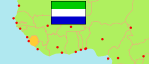
Koinadugu
District in Sierra Leone
Contents: Subdivision
The population development in Koinadugu as well as related information and services (Wikipedia, Google, images).
| Name | Status | Population Census 2004-12-04 | Population Census 2015-12-04 | Population Census 2021-12-09 | |
|---|---|---|---|---|---|
| Koinadugu | District | 135,005 | 204,019 | 206,133 | |
| Diang | Chiefdom | 19,700 | 29,063 | 32,480 | → |
| Gbonkobon Kayaka | Chiefdom | ... | 7,728 | 8,005 | → |
| Kalian | Chiefdom | ... | 22,267 | 18,669 | → |
| Kamukeh | Chiefdom | ... | 12,187 | 10,764 | → |
| Kasunko Kakellian | Chiefdom | ... | 10,824 | 17,299 | → |
| Nieni | Chiefdom | ... | 32,356 | 29,336 | → |
| Sengbe | Chiefdom | ... | 24,786 | 22,095 | → |
| Tamiso | Chiefdom | ... | 6,244 | 7,157 | → |
| Wara-Wara Bafodia | Chiefdom | ... | 22,419 | 11,666 | → |
| Wara-Wara Yagala | Chiefdom | 27,168 | 36,145 | 48,662 | → |
| Sierra Leone | Republic | 4,976,871 | 7,092,113 | 7,548,702 |
Source: Statistics Sierra Leone (web).
Explanation: Boundaries of districts and chiefdoms according to the administrative reorganization of 2017. The 2021 census is a mid-term census. The reasons for the significant differences between the 2015 and 2021 figures are unclear. Area figures are derived from geospatial data.