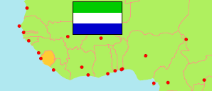
Kono
District in Sierra Leone
Contents: Subdivision
The population development in Kono as well as related information and services (Wikipedia, Google, images).
| Name | Status | Population Census 2004-12-04 | Population Census 2015-12-04 | Population Census 2021-12-09 | |
|---|---|---|---|---|---|
| Kono | District | 335,401 | 506,100 | 620,703 | |
| Fiama | Chiefdom | 9,091 | 15,455 | 13,415 | → |
| Gbane | Chiefdom | 14,813 | 24,404 | 28,043 | → |
| Gbane Kandor | Chiefdom | 4,163 | 11,903 | 9,488 | → |
| Gbense | Chiefdom | 24,599 | 15,864 | 21,146 | → |
| Gorama Kono | Chiefdom | 11,643 | 18,294 | 13,603 | → |
| Kamara | Chiefdom | 12,538 | 19,412 | 19,110 | → |
| Koidu | City | 80,025 | 128,030 | 196,418 | → |
| Lei | Chiefdom | 16,452 | 26,966 | 28,939 | → |
| Mafindor | Chiefdom | 6,801 | 13,703 | 10,314 | → |
| Nimikoro | Chiefdom | 44,295 | 61,225 | 80,475 | → |
| Nimiyama | Chiefdom | 26,140 | 28,168 | 42,657 | → |
| Sandor | Chiefdom | 49,971 | 89,879 | 94,515 | → |
| Soa | Chiefdom | 21,249 | 39,250 | 41,214 | → |
| Tankoro | Chiefdom | 11,014 | 8,501 | 17,268 | → |
| Toli | Chiefdom | 2,607 | 5,046 | 4,098 | → |
| Sierra Leone | Republic | 4,976,871 | 7,092,113 | 7,548,702 |
Source: Statistics Sierra Leone (web).
Explanation: Boundaries of districts and chiefdoms according to the administrative reorganization of 2017. The 2021 census is a mid-term census. The reasons for the significant differences between the 2015 and 2021 figures are unclear. Area figures are derived from geospatial data.