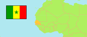
Kaffrine
Region in Senegal
Contents: Subdivision
The population development in Kaffrine as well as related information and services (Wikipedia, Google, images).
| Name | Status | Population Census 2013-11-19 | Population Census 2023-08-18 | |
|---|---|---|---|---|
| Kaffrine | Region | 566,992 | 820,405 | |
| Birkelane | Commune | 7,011 | 10,891 | → |
| Boulel | Rural Community | 23,408 | 30,083 | → |
| Darou Minam 2 | Rural Community | 14,866 | 21,301 | → |
| Diamagadio | Rural Community | 19,336 | 24,420 | → |
| Diamal | Rural Community | 10,250 | 15,776 | → |
| Dianké Souf | Rural Community | 19,036 | 25,357 | → |
| Diokoul Mbelbouck | Rural Community | 24,276 | 33,591 | → |
| Fass Thiékène | Rural Community | 15,867 | 23,547 | → |
| Gniby | Rural Community | 15,544 | 19,778 | → |
| Ida Mouride | Rural Community | 19,079 | 31,535 | → |
| Kaffrine | Commune | 39,537 | 57,307 | → |
| Kahi | Rural Community | 21,490 | 29,215 | → |
| Kathiotte | Rural Community | 32,963 | 44,396 | → |
| Keur Mboucki | Rural Community | 10,139 | 14,229 | → |
| Khelcom | Rural Community | 1,665 | 1,834 | → |
| Koungheul | Commune | 20,942 | 31,149 | → |
| Lour Escale | Rural Community | 22,530 | 34,905 | → |
| Mabo | Rural Community | 25,208 | 36,514 | → |
| Maka Yop | Rural Community | 13,823 | 19,428 | → |
| Malem-Hodar | Commune | 7,879 | 12,188 | → |
| Mbeuleup | Rural Community | 4,178 | 7,484 | → |
| Médinatoul Salam 2 | Rural Community | 20,612 | 27,628 | → |
| Missirah Wadène | Rural Community | 18,896 | 29,827 | → |
| Ndiobène Samba Lamo | Rural Community | 5,418 | 8,581 | → |
| Ndiognick | Rural Community | 29,776 | 44,449 | → |
| Ndioum Ngainth | Rural Community | 8,087 | 12,613 | → |
| Ngainthe Pathè | Rural Community | 15,490 | 25,769 | → |
| Nganda | Commune | 10,507 | 14,369 | → |
| Ribot Escale | Rural Community | 14,011 | 23,010 | → |
| Sagna | Rural Community | 37,712 | 53,375 | → |
| Saly Escale | Rural Community | 22,799 | 34,134 | → |
| Ségré Gatta | Rural Community | 4,730 | 7,307 | → |
| Touba Mbella | Rural Community | 9,922 | 14,414 | → |
| Sénégal | Republic | 13,508,715 | 18,126,390 |
Source: Agence Nationale de la Statistique et de la Démographie, Sénégal.
Explanation: Area figures of departments are computed by using geospatial data.