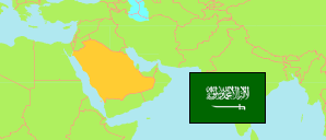
Saudi Arabia: Northern Borders Region
Governorates
The population of the governorates (muḥafaẓat) in Northern Borders Region by census years.
| Name | Native | Status | Population Census 2004-09-15 | Population Census 2010-04-28 | Population Census 2022-05-10 | |
|---|---|---|---|---|---|---|
| Al-'Awayqīlah [← 'Ar'ar] | العويقيله | Governorate | ... | ... | 20,318 | → |
| 'Ar'ar | عرعر | Governorate | 164,823 | 191,402 | 202,719 | → |
| Rafḥā' | رفحاء | Governorate | 73,363 | 81,201 | 84,536 | → |
| Ṭuraīf | طريف | Governorate | 41,785 | 49,277 | 66,004 | → |
| Al-Ḥudūd ash-Shamāliyah [Northern Borders] | الحدود الشمالية | Region | 279,971 | 321,880 | 373,577 |
Contents: Places
The population of all places with at least 2500 inhabitants in Northern Borders Region by census years.
| Name | Native | Status | Governorat | Population Census 2004-09-15 | Population Census 2010-04-28 | Population Census 2022-05-10 | |
|---|---|---|---|---|---|---|---|
| Al-'Awayqīlah | العويقيلة | Place | Al-'Awayqīlah | 12,110 | 14,121 | 17,055 | → |
| 'Ar'ar | عرعر | Place | 'Ar'ar | 143,283 | 167,057 | 199,247 | → |
| Mazar'at Jazā' al-Yarmān | مزرعة جزاع اليرمان | Place | Ṭuraīf | ... | ... | 2,545 | → |
| Rafḥā' | رفحاء | Place | Rafḥā' | 45,406 | 52,712 | 63,929 | → |
| Rawḍat Habās [Rawdat Habbas] | روضة هباس | Place | Rafḥā' | 4,953 | 5,532 | 5,620 | → |
| Sha'bih Naṣāb | شعبه نصاب | Place | Rafḥā' | 3,121 | ... | 3,430 | → |
| Ṭala'h at-Tamīāṭ | طلعه التمياط | Place | Rafḥā' | 4,195 | ... | 3,770 | → |
| Ṭuraīf | طريف | Place | Ṭuraīf | 41,230 | 48,108 | 61,395 | → |
Source: General Statistics Authority, Kingdom of Saudi Arabia (web).
Explanation: Population changes are partly result of boundary changes. Area figures are computed by using geospatial data.