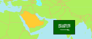
Aḥad al-Masāriḥah
Governorate in Jazan Region
Governorate
The population development of Aḥad al-Masāriḥah.
| Name | Native | Status | Population Census 2004-09-15 | Population Census 2010-04-28 | Population Census 2022-05-10 | |
|---|---|---|---|---|---|---|
| Aḥad al-Masāriḥah | أحد المسارحة | Governorate | 70,038 | 109,866 | 130,545 | → |
| Jāzān [Jazan] | جازان | Region | 1,187,587 | 1,374,845 | 1,404,997 |
Contents: Places
The population development of the places in Aḥad al-Masāriḥah.
| Name | Native | Status | Governorat | Population Census 2004-09-15 | Population Census 2010-04-28 | Population Census 2022-05-10 | |
|---|---|---|---|---|---|---|---|
| Aḥad al-Masāriḥah | أحد المسارحة | Place | Aḥad al-Masāriḥah | 18,000 | 25,007 | 25,670 | → |
| Al-Bayṭāryah | البيطاريه | Place | Aḥad al-Masāriḥah | 1,641 | ... | 4,774 | → |
| Al-Ḥaṣmah | الحصمة | Place | Aḥad al-Masāriḥah | 656 | ... | 13,028 | → |
| Al-Maḍāyā | المضايا | Place | Aḥad al-Masāriḥah | 7,007 | 7,752 | 7,330 | → |
| Al-Manjārah | المنجاره | Place | Aḥad al-Masāriḥah | 3,034 | ... | 2,829 | → |
| Aṣ-Ṣawārimah | الصوارمه | Place | Aḥad al-Masāriḥah | ... | ... | 2,750 | → |
| Juḥā | جحا | Place | Aḥad al-Masāriḥah | 2,927 | ... | 2,656 | → |
| Mazharah | مزهرة | Place | Aḥad al-Masāriḥah | 5,284 | 5,849 | 6,397 | → |
| Ramādah | رماده | Place | Aḥad al-Masāriḥah | 744 | ... | 8,607 | → |
| Sūq al-Laīl | سوق الليل | Place | Aḥad al-Masāriḥah | 1,589 | ... | 3,461 | → |
Source: General Statistics Authority, Kingdom of Saudi Arabia (web).
Explanation: Population changes are partly result of boundary changes. Area figures are computed by using geospatial data.