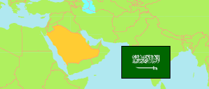
Ḥafar al-Bāṭin
Governorate in Eastern Region Region
Governorate
The population development of Ḥafar al-Bāṭin.
| Name | Native | Status | Population Census 2004-09-15 | Population Census 2010-04-28 | Population Census 2022-05-10 | |
|---|---|---|---|---|---|---|
| Ḥafar al-Bāṭin | حفر الباطن | Governorate | 338,764 | 387,102 | 467,007 | → |
| Ash-Sharqiyah [Eastern Region] | المنطقة الشرقية | Region | 3,360,031 | 4,130,033 | 5,125,254 |
Contents: Places
The population development of the places in Ḥafar al-Bāṭin.
| Name | Native | Status | Governorat | Population Census 2004-09-15 | Population Census 2010-04-28 | Population Census 2022-05-10 | |
|---|---|---|---|---|---|---|---|
| Adh-Dhībiyah [Thebea] | الذيبية | Place | Ḥafar al-Bāṭin | 12,249 | 14,442 | 17,502 | → |
| Al-Qaīṣūmah | القيصومة | Place | Ḥafar al-Bāṭin | 20,348 | 22,538 | 27,307 | → |
| Ḥafar al-Bāṭin | حفر الباطن | Place | Ḥafar al-Bāṭin | 231,866 | 271,642 | 387,096 | → |
| Madīnat al-Malik Khālid al-'Askariyah [King Khalid Military City] | مدينة الملك خالد العسكرية | Military Institution | Ḥafar al-Bāṭin | 54,414 | ... | 25,356 | → |
Source: General Statistics Authority, Kingdom of Saudi Arabia (web).
Explanation: Population changes are partly result of boundary changes. Area figures are computed by using geospatial data.