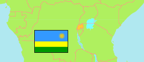
Ngororero
District in Rwanda
Contents: Subdivision
The population development in Ngororero as well as related information and services (Wikipedia, Google, images).
| Name | Status | Population Census 2012-08-15 | Population Census 2022-08-15 | |
|---|---|---|---|---|
| Ngororero | District | 333,713 | 367,955 | |
| Bwira | Sector | 18,632 | 20,012 | → |
| Gatumba | Sector | 23,707 | 24,952 | → |
| Hindiro | Sector | 24,312 | 26,040 | → |
| Kabaya | Sector | 34,085 | 36,324 | → |
| Kageyo | Sector | 23,080 | 25,929 | → |
| Kavumu | Sector | 28,165 | 32,791 | → |
| Matyazo | Sector | 25,914 | 27,673 | → |
| Muhanda | Sector | 28,247 | 31,869 | → |
| Muhororo | Sector | 21,463 | 22,273 | → |
| Ndaro | Sector | 22,762 | 24,444 | → |
| Ngororero | Sector | 34,559 | 38,823 | → |
| Nyange | Sector | 21,932 | 24,859 | → |
| Sovu | Sector | 26,855 | 31,966 | → |
| Rwanda | Republic | 10,515,973 | 13,246,394 |
Source: National Institute of Statistics Rwanda.
Further information about the population structure:
| Gender (C 2022) | |
|---|---|
| Males | 171,065 |
| Females | 196,890 |
| Age Groups (C 2022) | |
|---|---|
| 0-14 years | 144,461 |
| 15-64 years | 206,832 |
| 65+ years | 16,662 |
| Age Distribution (C 2022) | |
|---|---|
| 80+ years | 3,198 |
| 70-79 years | 6,438 |
| 60-69 years | 16,933 |
| 50-59 years | 20,155 |
| 40-49 years | 32,492 |
| 30-39 years | 47,361 |
| 20-29 years | 53,411 |
| 10-19 years | 90,996 |
| 0-9 years | 96,971 |
| Urbanization (C 2022) | |
|---|---|
| Rural | 349,813 |
| Urban | 18,142 |