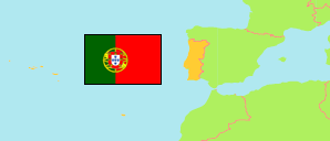
Oliveira de Azeméis
Municipality in Aveiro District
Contents: Subdivision
The population development in Oliveira de Azeméis as well as related information and services (Wikipedia, Google, images).
| Name | Status | Population Census 2001-03-12 | Population Census 2011-03-21 | Population Census 2021-03-22 | |
|---|---|---|---|---|---|
| Oliveira de Azeméis | Municipality | 70,721 | 68,611 | 66,175 | |
| Carregosa | Parish | 3,552 | 3,419 | 3,466 | → |
| Cesar | Parish | 3,288 | 3,166 | 3,072 | → |
| Fajões | Parish | 3,180 | 3,087 | 2,896 | → |
| Loureiro | Parish | 3,491 | 3,531 | 3,638 | → |
| Macieira de Sarnes | Parish | 2,214 | 1,925 | 1,856 | → |
| Nogueira do Cravo e Pindelo | Parish | 5,610 | 5,390 | 5,090 | → |
| Oliveira de Azeméis, Santiago de Riba-Ul, Ul, Macinhata da Seixa e Madail | Parish | 20,456 | 20,760 | 20,665 | → |
| Ossela | Parish | 2,538 | 2,208 | 1,918 | → |
| Pinheiro da Bemposta, Travanca e Palmaz | Parish | 7,529 | 7,207 | 6,735 | → |
| São Martinho da Gândara | Parish | 2,289 | 1,985 | 1,854 | → |
| São Roque | Parish | 5,480 | 5,228 | 5,023 | → |
| Vila de Cucujães | Parish | 11,094 | 10,705 | 9,962 | → |
| Aveiro | District | 713,575 | 714,197 | 700,787 |
Source: Instituto Nacional de Estatística Portugal (web).
Further information about the population structure:
| Gender (C 2021) | |
|---|---|
| Males | 32,020 |
| Females | 34,155 |
| Age Groups (C 2021) | |
|---|---|
| 0-14 years | 7,679 |
| 15-64 years | 43,227 |
| 65+ years | 15,269 |
| Age Distribution (C 2021) | |
|---|---|
| 80+ years | 4,280 |
| 70-79 years | 6,731 |
| 60-69 years | 9,260 |
| 50-59 years | 10,636 |
| 40-49 years | 9,758 |
| 30-39 years | 7,515 |
| 20-29 years | 7,135 |
| 10-19 years | 6,016 |
| 0-9 years | 4,844 |
| Citizenship (C 2021) | |
|---|---|
| Portugal | 64,882 |
| EU | 149 |
| Europe (other) | 99 |
| Africa | 134 |
| America | 814 |
| Asia & Oceania | 97 |
| Country of Birth (C 2021) | |
|---|---|
| Portugal | 62,327 |
| EU | 710 |
| Europe (other) | 321 |
| Africa | 912 |
| America | 1,798 |
| Asia & Oceania | 107 |