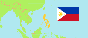
Samar
Province in Visayas
Contents: Subdivision
The population development in Samar as well as related information and services (Wikipedia, Google, images).
| Name | Status | Population Census 1990-05-01 | Population Census 2000-05-01 | Population Census 2010-05-01 | Population Census 2015-08-01 | Population Census 2020-05-01 | Population Census 2024-07-01 | |
|---|---|---|---|---|---|---|---|---|
| Samar (Western Samar) | Province | 533,733 | 641,124 | 733,377 | 780,481 | 793,183 | 806,179 | |
| Almagro | Municipality | 8,578 | 10,619 | 11,024 | 8,942 | 9,273 | 8,571 | → |
| Basey | Municipality | 39,137 | 43,809 | 50,423 | 55,480 | 56,685 | 57,645 | → |
| Calbayog | City | 115,390 | 147,187 | 172,778 | 183,851 | 186,960 | 187,848 | → |
| Calbiga | Municipality | 17,116 | 18,890 | 21,434 | 22,982 | 23,310 | 23,309 | → |
| Catbalogan | City | 70,470 | 84,180 | 94,317 | 103,879 | 106,440 | 107,896 | → |
| Daram | Municipality | 31,332 | 35,532 | 41,322 | 42,879 | 41,608 | 41,932 | → |
| Gandara | Municipality | 23,673 | 28,866 | 31,943 | 34,434 | 35,242 | 36,826 | → |
| Hinabangan | Municipality | 11,906 | 12,120 | 12,651 | 13,673 | 13,693 | 13,791 | → |
| Jiabong | Municipality | 12,751 | 15,397 | 17,075 | 18,342 | 19,205 | 19,482 | → |
| Marabut | Municipality | 10,543 | 12,335 | 15,115 | 16,962 | 17,842 | 18,168 | → |
| Matuguinao | Municipality | 3,819 | 5,361 | 6,746 | 7,288 | 7,364 | 7,708 | → |
| Motiong | Municipality | 12,115 | 13,147 | 14,829 | 15,156 | 15,276 | 15,887 | → |
| Pagsanghan | Municipality | 6,047 | 7,077 | 8,024 | 7,945 | 7,959 | 8,145 | → |
| Paranas (Wright) | Municipality | 22,702 | 27,926 | 29,327 | 30,557 | 32,374 | 35,281 | → |
| Pinabacdao | Municipality | 10,361 | 13,167 | 16,208 | 18,252 | 18,136 | 18,639 | → |
| San Jorge | Municipality | 10,111 | 13,376 | 16,340 | 17,184 | 17,579 | 17,863 | → |
| San Jose de Buan | Municipality | 4,217 | 6,438 | 6,563 | 7,769 | 7,767 | 7,939 | → |
| San Sebastian | Municipality | 5,732 | 6,779 | 7,708 | 8,057 | 8,704 | 9,110 | → |
| Santa Margarita | Municipality | 16,878 | 21,740 | 24,850 | 26,348 | 26,816 | 27,012 | → |
| Santa Rita | Municipality | 25,202 | 30,118 | 38,082 | 41,591 | 42,384 | 42,397 | → |
| Santo Niño | Municipality | 11,743 | 12,545 | 13,504 | 12,863 | 12,519 | 13,088 | → |
| Tagapul-an | Municipality | 6,760 | 8,370 | 7,828 | 8,473 | 8,805 | 9,139 | → |
| Talalora | Municipality | 6,112 | 6,580 | 7,983 | 8,057 | 7,856 | 8,530 | → |
| Tarangnan | Municipality | 15,894 | 20,538 | 24,146 | 24,992 | 25,713 | 26,013 | → |
| Villareal | Municipality | 21,820 | 23,604 | 26,221 | 28,230 | 27,394 | 27,909 | → |
| Zumarraga | Municipality | 13,324 | 15,423 | 16,936 | 16,295 | 16,279 | 16,051 | → |
| Visayas | Island Group | 13,041,947 | 15,528,346 | 18,003,940 | 19,373,431 | 20,583,861 | 21,033,659 |
Source: Philippines Statistics Authority.
Explanation: Area figures are computed by using geospatial data.
Further information about the population structure:
| Gender (C 2020) | |
|---|---|
| Males | 406,789 |
| Females | 384,256 |
| Age Groups (C 2020) | |
|---|---|
| 0-14 years | 265,302 |
| 15-64 years | 479,232 |
| 65+ years | 46,511 |
| Age Distribution (C 2020) | |
|---|---|
| 80+ years | 7,860 |
| 70-79 years | 21,497 |
| 60-69 years | 41,053 |
| 50-59 years | 64,018 |
| 40-49 years | 80,004 |
| 30-39 years | 89,667 |
| 20-29 years | 132,636 |
| 10-19 years | 178,217 |
| 0-9 years | 176,093 |