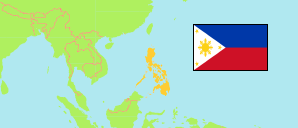
Sariaya
Municipality in Luzon
Contents: Population
The population development of Sariaya as well as related information and services (Wikipedia, Google, images).
| Name | Status | Population Census 1990-05-01 | Population Census 2000-05-01 | Population Census 2010-05-01 | Population Census 2015-08-01 | Population Census 2020-05-01 | Population Census 2024-07-01 | |
|---|---|---|---|---|---|---|---|---|
| Sariaya | Municipality | 91,081 | 114,568 | 138,894 | 148,980 | 161,868 | 172,018 | |
| Luzon | Island Group | 33,357,887 | 42,822,878 | 52,362,999 | 57,470,097 | 62,196,942 | 64,162,977 |
Source: Philippines Statistics Authority.
Explanation: Area figures are computed by using geospatial data.
Further information about the population structure:
| Gender (C 2020) | |
|---|---|
| Males | 81,665 |
| Females | 80,002 |
| Age Groups (C 2020) | |
|---|---|
| 0-14 years | 50,488 |
| 15-64 years | 102,320 |
| 65+ years | 8,859 |
| Age Distribution (C 2020) | |
|---|---|
| 80+ years | 1,371 |
| 70-79 years | 3,648 |
| 60-69 years | 9,053 |
| 50-59 years | 14,247 |
| 40-49 years | 18,808 |
| 30-39 years | 21,951 |
| 20-29 years | 26,505 |
| 10-19 years | 32,830 |
| 0-9 years | 33,254 |