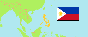
Kalinga
Province in Luzon
Contents: Subdivision
The population development in Kalinga as well as related information and services (Wikipedia, Google, images).
| Name | Status | Population Census 1990-05-01 | Population Census 2000-05-01 | Population Census 2010-05-01 | Population Census 2015-08-01 | Population Census 2020-05-01 | Population Census 2024-07-01 | |
|---|---|---|---|---|---|---|---|---|
| Kalinga | Province | 137,055 | 174,023 | 201,613 | 212,680 | 229,570 | 235,391 | |
| Balbalan | Municipality | 10,147 | 11,934 | 12,082 | 12,195 | 12,914 | 13,332 | → |
| Lubuagan | Municipality | 9,189 | 9,875 | 9,369 | 8,733 | 9,323 | 8,660 | → |
| Pasil | Municipality | 7,572 | 9,360 | 9,626 | 9,644 | 10,577 | 10,690 | → |
| Pinukpuk | Municipality | 20,102 | 26,130 | 29,596 | 32,026 | 34,275 | 35,033 | → |
| Rizal (Liwan) | Municipality | 10,885 | 13,652 | 15,942 | 17,038 | 19,554 | 20,491 | → |
| Tabuk | City | 57,200 | 78,633 | 103,912 | 110,642 | 121,033 | 122,771 | → |
| Tanudan | Municipality | 9,323 | 10,275 | 8,529 | 9,534 | 8,746 | 11,103 | → |
| Tinglayan | Municipality | 12,637 | 14,164 | 12,557 | 12,868 | 13,148 | 13,311 | → |
| Luzon | Island Group | 33,357,887 | 42,822,878 | 52,362,999 | 57,470,097 | 62,196,942 | 64,162,977 |
Source: Philippines Statistics Authority.
Explanation: Area figures are computed by using geospatial data.
Further information about the population structure:
| Gender (C 2020) | |
|---|---|
| Males | 118,539 |
| Females | 110,789 |
| Age Groups (C 2020) | |
|---|---|
| 0-14 years | 70,011 |
| 15-64 years | 146,003 |
| 65+ years | 13,314 |
| Age Distribution (C 2020) | |
|---|---|
| 80+ years | 2,567 |
| 70-79 years | 5,559 |
| 60-69 years | 12,140 |
| 50-59 years | 18,127 |
| 40-49 years | 23,450 |
| 30-39 years | 30,917 |
| 20-29 years | 42,361 |
| 10-19 years | 48,369 |
| 0-9 years | 45,838 |