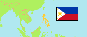
Abra
Province in Luzon
Contents: Subdivision
The population development in Abra as well as related information and services (Wikipedia, Google, images).
| Name | Status | Population Census 1990-05-01 | Population Census 2000-05-01 | Population Census 2010-05-01 | Population Census 2015-08-01 | Population Census 2020-05-01 | Population Census 2024-07-01 | |
|---|---|---|---|---|---|---|---|---|
| Abra | Province | 184,743 | 209,491 | 234,733 | 241,160 | 250,985 | 246,948 | |
| Bangued | Municipality | 34,184 | 38,965 | 43,936 | 48,163 | 50,382 | 48,331 | → |
| Boliney | Municipality | 3,773 | 3,340 | 4,063 | 3,573 | 4,551 | 3,778 | → |
| Bucay | Municipality | 13,346 | 14,881 | 17,126 | 17,115 | 17,953 | 17,775 | → |
| Bucloc | Municipality | 1,932 | 2,109 | 2,176 | 2,501 | 2,395 | 2,264 | → |
| Daguioman | Municipality | 1,413 | 1,748 | 1,715 | 2,088 | 2,019 | 1,773 | → |
| Danglas | Municipality | 3,042 | 4,144 | 4,734 | 4,192 | 4,074 | 4,372 | → |
| Dolores | Municipality | 8,577 | 9,949 | 11,499 | 11,315 | 11,512 | 11,967 | → |
| Lacub | Municipality | 2,326 | 2,782 | 2,977 | 3,403 | 3,612 | 3,649 | → |
| Lagangilang | Municipality | 11,248 | 12,073 | 13,824 | 14,255 | 14,914 | 14,577 | → |
| Lagayan | Municipality | 3,771 | 3,894 | 4,477 | 4,499 | 4,488 | 5,154 | → |
| Langiden | Municipality | 2,452 | 2,998 | 3,170 | 3,198 | 3,576 | 3,457 | → |
| La Paz | Municipality | 11,240 | 12,922 | 14,882 | 15,437 | 16,493 | 16,014 | → |
| Licuan-Baay (Licuan) | Municipality | 3,697 | 3,812 | 4,864 | 4,689 | 4,566 | 4,301 | → |
| Luba | Municipality | 5,563 | 6,203 | 6,391 | 6,339 | 6,518 | 6,402 | → |
| Malibcong | Municipality | 3,494 | 3,806 | 3,807 | 3,428 | 4,027 | 4,167 | → |
| Manabo | Municipality | 7,797 | 9,643 | 10,756 | 10,761 | 11,611 | 11,087 | → |
| Peñarrubia | Municipality | 4,893 | 5,515 | 6,544 | 6,640 | 6,951 | 7,003 | → |
| Pidigan | Municipality | 8,807 | 10,183 | 11,528 | 12,185 | 12,475 | 12,058 | → |
| Pilar | Municipality | 8,451 | 9,328 | 9,908 | 10,223 | 10,146 | 10,498 | → |
| Sallapadan | Municipality | 4,941 | 5,497 | 5,985 | 6,622 | 6,389 | 6,328 | → |
| San Isidro | Municipality | 3,744 | 4,293 | 4,888 | 4,574 | 4,745 | 4,771 | → |
| San Juan | Municipality | 8,445 | 8,821 | 10,546 | 9,867 | 10,688 | 10,777 | → |
| San Quintin | Municipality | 4,293 | 5,130 | 5,233 | 5,438 | 5,705 | 5,963 | → |
| Tayum | Municipality | 11,045 | 12,539 | 13,940 | 14,467 | 14,869 | 14,808 | → |
| Tineg | Municipality | 3,068 | 4,995 | 4,668 | 5,097 | 4,977 | 5,059 | → |
| Tubo | Municipality | 4,589 | 5,044 | 5,719 | 5,699 | 5,674 | 4,941 | → |
| Villaviciosa | Municipality | 4,612 | 4,877 | 5,377 | 5,392 | 5,675 | 5,674 | → |
| Luzon | Island Group | 33,357,887 | 42,822,878 | 52,362,999 | 57,470,097 | 62,196,942 | 64,162,977 |
Source: Philippines Statistics Authority.
Explanation: Area figures are computed by using geospatial data.
Further information about the population structure:
| Gender (C 2020) | |
|---|---|
| Males | 127,632 |
| Females | 122,677 |
| Age Groups (C 2020) | |
|---|---|
| 0-14 years | 69,116 |
| 15-64 years | 161,144 |
| 65+ years | 20,049 |
| Age Distribution (C 2020) | |
|---|---|
| 80+ years | 4,578 |
| 70-79 years | 8,065 |
| 60-69 years | 17,245 |
| 50-59 years | 23,072 |
| 40-49 years | 27,474 |
| 30-39 years | 34,627 |
| 20-29 years | 40,804 |
| 10-19 years | 50,498 |
| 0-9 years | 43,946 |