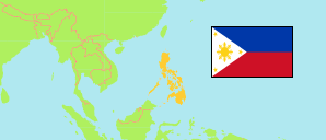
Aurora
Province in Luzon
Contents: Subdivision
The population development in Aurora as well as related information and services (Wikipedia, Google, images).
| Name | Status | Population Census 1990-05-01 | Population Census 2000-05-01 | Population Census 2010-05-01 | Population Census 2015-08-01 | Population Census 2020-05-01 | Population Census 2024-07-01 | |
|---|---|---|---|---|---|---|---|---|
| Aurora | Province | 139,573 | 173,797 | 201,233 | 214,336 | 235,750 | 240,824 | |
| Baler | Municipality | 24,689 | 29,923 | 36,010 | 39,562 | 43,785 | 44,684 | → |
| Casiguran | Municipality | 18,388 | 21,459 | 23,865 | 24,313 | 26,564 | 26,855 | → |
| Dilasag | Municipality | 11,195 | 14,676 | 15,683 | 15,835 | 17,102 | 17,536 | → |
| Dinalungan | Municipality | 6,770 | 9,711 | 10,988 | 11,322 | 12,508 | 12,552 | → |
| Dingalan | Municipality | 14,475 | 20,157 | 23,554 | 25,482 | 27,878 | 29,286 | → |
| Dipaculao | Municipality | 18,951 | 23,064 | 27,729 | 29,736 | 33,131 | 33,597 | → |
| Maria Aurora | Municipality | 28,378 | 33,551 | 38,128 | 40,734 | 44,958 | 45,972 | → |
| San Luis | Municipality | 16,740 | 21,256 | 25,276 | 27,352 | 29,824 | 30,342 | → |
| Luzon | Island Group | 33,357,887 | 42,822,878 | 52,362,999 | 57,470,097 | 62,196,942 | 64,162,977 |
Source: Philippines Statistics Authority.
Explanation: Area figures are computed by using geospatial data.
Further information about the population structure:
| Gender (C 2020) | |
|---|---|
| Males | 120,266 |
| Females | 114,725 |
| Age Groups (C 2020) | |
|---|---|
| 0-14 years | 74,078 |
| 15-64 years | 148,133 |
| 65+ years | 12,780 |
| Age Distribution (C 2020) | |
|---|---|
| 80+ years | 2,000 |
| 70-79 years | 5,480 |
| 60-69 years | 12,810 |
| 50-59 years | 20,244 |
| 40-49 years | 25,685 |
| 30-39 years | 31,168 |
| 20-29 years | 39,735 |
| 10-19 years | 49,249 |
| 0-9 years | 48,620 |