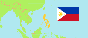
La Union
Province in Philippines
Contents: Population
The population development of La Union as well as related information and services (Wikipedia, Google, images).
| Name | Status | Population Census 1990-05-01 | Population Census 2000-05-01 | Population Census 2010-05-01 | Population Census 2015-08-01 | Population Census 2020-05-01 | Population Census 2024-07-01 | |
|---|---|---|---|---|---|---|---|---|
| La Union | Province | 548,742 | 657,945 | 741,906 | 786,653 | 822,352 | 825,072 | |
| Pilipinas [Philippines] | Republic | 60,703,810 | 76,506,928 | 92,337,852 | 100,981,437 | 109,035,343 | 112,729,484 |
Source: Philippines Statistics Authority.
Explanation: Area figures are calculated by using geospatial data.
Further information about the population structure:
| Gender (C 2020) | |
|---|---|
| Males | 414,862 |
| Females | 405,481 |
| Age Groups (C 2020) | |
|---|---|
| 0-14 years | 216,040 |
| 15-64 years | 541,908 |
| 65+ years | 62,395 |
| Age Distribution (C 2020) | |
|---|---|
| 80+ years | 12,252 |
| 70-79 years | 26,599 |
| 60-69 years | 55,715 |
| 50-59 years | 80,194 |
| 40-49 years | 97,050 |
| 30-39 years | 118,281 |
| 20-29 years | 139,187 |
| 10-19 years | 150,512 |
| 0-9 years | 140,553 |