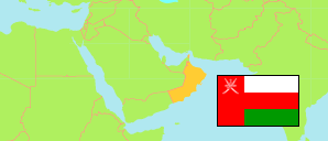
Al-Jāzer
District in Al Wusta Governorate
District
The population development of Al-Jāzer.
| Name | Native | Status | Population Census 2003-12-07 | Population Census 2010-12-12 | Population Census 2020-12-12 | |
|---|---|---|---|---|---|---|
| Al-Jāzer | الجازر | District | 5,820 | 7,933 | 5,645 | → |
| Al-Wusṭa [Al Wusta] | الوسطى | Governorate | 23,307 | 42,111 | 52,344 |
Contents: Localities
The population development of the localities in Al-Jāzer.
| Name | Native | Status | District | Population Census 2003-12-07 | Population Census 2010-12-12 | Population Census 2020-12-12 | |
|---|---|---|---|---|---|---|---|
| Al-Ghubrah al-Janubiyah | الغبرة الجنوبية | Locality | Al-Jāzer | 310 | 347 | 375 | → |
| Al-Ghubrah ash-Shamaliyah | الغبرة الشمالية | Locality | Al-Jāzer | 359 | 539 | 705 | → |
| Al-Jashrib | الجشريب | Locality | Al-Jāzer | 76 | 165 | 291 | → |
| Al-Kahil | الكحل | Locality | Al-Jāzer | 497 | 758 | 1,311 | → |
| Al-Kahil 2 | الكحل 2 | Locality | Al-Jāzer | ... | 51 | 127 | → |
| Al-Lakbi | اللكبي | Locality | Al-Jāzer | 726 | 751 | 979 | → |
| Barqat | برقت | Locality | Al-Jāzer | 81 | 61 | 62 | → |
| Fadi | فاضي | Locality | Al-Jāzer | 121 | 80 | 136 | → |
| Madir | مادر | Locality | Al-Jāzer | 207 | 263 | 453 | → |
| Sawqrah | صوقرة | Locality | Al-Jāzer | 545 | 568 | 744 | → |
| Wadi Ghayl | وادي غيل | Locality | Al-Jāzer | 51 | 218 | 180 | → |
Source: Sultanate of Oman, National Centre for Statistics and Information (web).
Explanation: The 2020 census was organized as an electronic census.