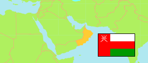
Rakhyūt
District in Dhofar Governorate
District
The population development of Rakhyūt.
| Name | Native | Status | Population Census 2003-12-07 | Population Census 2010-12-12 | Population Census 2020-12-12 | |
|---|---|---|---|---|---|---|
| Rakhyūt | رخيوت | District | 4,488 | 4,501 | 4,985 | → |
| Ẓufār [Dhofar] | ظفار | Governorate | 215,960 | 249,729 | 416,458 |
Contents: Localities
The population development of the localities in Rakhyūt.
| Name | Native | Status | District | Population Census 2003-12-07 | Population Census 2010-12-12 | Population Census 2020-12-12 | |
|---|---|---|---|---|---|---|---|
| Ajdarawt | اجدروت | Locality | Rakhyūt | 118 | 159 | 215 | → |
| Anzut | انزوت | Locality | Rakhyūt | 263 | 241 | 265 | → |
| Aqtadanut | اقتدانوت | Locality | Rakhyūt | 113 | 90 | 67 | → |
| Ardayt | ارديت | Locality | Rakhyūt | 40 | 47 | 106 | → |
| Arift | عرفت | Locality | Rakhyūt | 188 | 323 | 361 | → |
| Arift / Hasal | عرفت / حصل | Locality | Rakhyūt | ... | 164 | 164 | → |
| Arjut | ارجوت | Locality | Rakhyūt | 71 | 96 | 170 | → |
| Arjut Ashkharayt | أرجوت أشخريت | Locality | Rakhyūt | ... | 195 | 113 | → |
| Ashqul | اشقول | Locality | Rakhyūt | 386 | 326 | 333 | → |
| Barq | برق | Locality | Rakhyūt | 127 | 109 | 106 | → |
| Dar Shaat | دارشعت | Locality | Rakhyūt | 55 | 60 | 69 | → |
| Jidayrt | جديرت | Locality | Rakhyūt | 48 | 44 | 88 | → |
| Kayzit Amqat | كيزيت عمقات | Locality | Rakhyūt | 73 | 69 | 50 | → |
| Kizayt Isuq | كيزيت اسوق | Locality | Rakhyūt | 147 | 140 | 73 | → |
| Maqurah | مقورح | Locality | Rakhyūt | 306 | 331 | 457 | → |
| Qarhunti | قرحنتي | Locality | Rakhyūt | 198 | 176 | 213 | → |
| Qayfuz Shaat | قيفوزشعت | Locality | Rakhyūt | 136 | 122 | 128 | → |
| Rakhyut | رخيوت | Locality | Rakhyūt | 457 | 504 | 706 | → |
| Shahab | شاهاب | Locality | Rakhyūt | 107 | 108 | 179 | → |
| Shahb Asayb | شهب اصعيب | Locality | Rakhyūt | 144 | 162 | 339 | → |
| Sharshatti | شرشتي | Locality | Rakhyūt | 104 | 167 | 67 | → |
| Shisar | شيصر | Locality | Rakhyūt | 139 | 131 | 118 | → |
| Wadi Darq | وادي ضرق | Locality | Rakhyūt | 90 | 102 | 141 | → |
Source: Sultanate of Oman, National Centre for Statistics and Information (web).
Explanation: The 2020 census was organized as an electronic census.