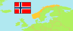
Hvaler
Municipality in Oslofjord
Contents: Subdivision
The population development in Hvaler as well as related information and services (Wikipedia, Google, images).
| Name | Status | Population Estimate 2000-01-01 | Population Estimate 2006-01-01 | Population Estimate 2013-01-01 | Population Estimate 2020-01-01 | Population Estimate 2025-01-01 | |
|---|---|---|---|---|---|---|---|
| Hvaler | Municipality | 3,494 | 3,821 | 4,284 | 4,668 | 4,777 | |
| Asmaløy | Statistical Unit | 572 | 778 | 950 | 1,067 | 1,159 | → |
| Brekke | Statistical Unit | 141 | 139 | 110 | 113 | 102 | → |
| Dammyr | Statistical Unit | 90 | 85 | 84 | 94 | 81 | → |
| Hauge | Statistical Unit | 459 | 487 | 523 | 584 | 577 | → |
| Herføl - Lauer | Statistical Unit | 20 | 33 | 28 | 24 | 35 | → |
| Kile | Statistical Unit | 163 | 151 | 152 | 148 | 153 | → |
| Nordre Sandøy - Singeløy | Statistical Unit | 16 | 14 | 5 | 5 | 4 | → |
| Papper | Statistical Unit | 153 | 119 | 97 | 86 | 84 | → |
| Skjærhalden | Statistical Area | 567 | 660 | 825 | 906 | 920 | → |
| Skjelsbo - Langekil | Statistical Unit | 384 | 450 | 637 | 703 | 708 | → |
| Søndre Sandøy | Statistical Unit | 82 | 77 | 86 | 110 | 116 | → |
| Spjærøy | Statistical Area | 393 | 341 | 307 | 340 | 337 | → |
| Storrød | Statistical Unit | 105 | 118 | 117 | 119 | 145 | → |
| Utgård | Statistical Unit | 344 | 360 | 355 | 364 | 352 | → |
| Oslofjorden [Oslofjord] | 1,370,013 | 1,447,704 | 1,629,375 | 1,783,859 | 1,886,118 |
Source: Statistics Norway.
Further information about the population structure:
| Gender (E 2025) | |
|---|---|
| Males | 2,416 |
| Females | 2,361 |
| Age Groups (E 2025) | |
|---|---|
| 0-19 years | 810 |
| 20-66 years | 2,593 |
| 67+ years | 1,374 |