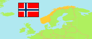
Stranda
Municipality in Møre og Romsdal (Norway)
Contents: Population
The population development of Stranda as well as related information and services (Wikipedia, Google, images).
| Name | Status | Population Estimate 1986-01-01 | Population Estimate 1993-01-01 | Population Estimate 2000-01-01 | Population Estimate 2006-01-01 | Population Estimate 2013-01-01 | Population Estimate 2020-01-01 | Population Estimate 2025-01-01 | |||||||||||
|---|---|---|---|---|---|---|---|---|---|---|---|---|---|---|---|---|---|---|---|
| Stranda | Municipality | 4,745 | 4,542 | 4,677 | 4,544 | 4,610 | 4,523 | 4,380 | |||||||||||
Stranda 4,380 Population [2025] – Estimate 844.9 km² Area 5.184/km² Population Density [2025] -0.64% Annual Population Change [2020 → 2025] | |||||||||||||||||||
| Norge (Noreg) [Norway] | Kingdom | 4,159,187 | 4,299,167 | 4,478,497 | 4,640,219 | 5,051,275 | 5,367,580 | 5,594,340 | |||||||||||
Source: Statistics Norway.
Explanation: Counties according to the reestablishment of former counties by 1 January 2024.
Further information about the population structure:
| Gender (E 2025) | |
|---|---|
| Males | 2,259 |
| Females | 2,121 |
| Age Groups (E 2025) | |
|---|---|
| 0-17 years | 746 |
| 18-64 years | 2,597 |
| 65+ years | 1,037 |
| Age Distribution (E 2025) | |
|---|---|
| 90+ years | 76 |
| 80-89 years | 258 |
| 70-79 years | 445 |
| 60-69 years | 538 |
| 50-59 years | 643 |
| 40-49 years | 550 |
| 30-39 years | 584 |
| 20-29 years | 441 |
| 10-19 years | 477 |
| 0-9 years | 368 |
| Citizenship (E 2025) | |
|---|---|
| Norway | 3,474 |
| Foreign Citizenship | 906 |
| Country of Birth (E 2025) | |
|---|---|
| Norway | 3,394 |
| Europe | 815 |
| Africa | 8 |
| Asia | 127 |
| Other country | 36 |
