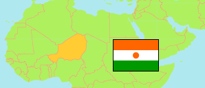
Dakoro
Department in Niger
Contents: Subdivision
The population development in Dakoro as well as related information and services (Wikipedia, Google, images).
| Name | Status | Population Census 2001-05-20 | Population Census 2012-12-10 | |
|---|---|---|---|---|
| Dakoro | Department | 417,031 | 630,421 | |
| Adjékoria | Commune | 51,502 | 79,108 | → |
| Azagor | Commune | 3,635 | 5,565 | → |
| Bader Goula | Commune | 45,142 | 68,203 | → |
| Birni Lallé | Commune | 22,477 | 30,846 | → |
| Dakoro | Commune | 42,126 | 71,201 | → |
| Dan-Goulbi | Commune | 31,918 | 57,228 | → |
| Korahane | Commune | 6,846 | 12,577 | → |
| Kornaka | Commune | 105,097 | 140,009 | → |
| Maïyara | Commune | 40,196 | 62,441 | → |
| Roumboui | Commune | 8,834 | 13,330 | → |
| Sabon-Machi | Commune | 25,205 | 35,988 | → |
| Tagriss | Commune | 34,053 | 53,925 | → |
| Niger | Republic | 11,060,291 | 17,138,707 |
Source: Institut National de la Statistique du Niger (web).
Explanation: Area figures are computed by using geospatial data.