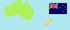
Bunnythorpe
in Manawatū-Wanganui (North Island)
Contents: Rural Settlement
The population development of Bunnythorpe as well as related information and services (weather, Wikipedia, Google, images).
| Name | Region | Population Estimate 1996-06-30 | Population Estimate 2001-06-30 | Population Estimate 2006-06-30 | Population Estimate 2013-06-30 | Population Estimate 2018-06-30 | Population Estimate 2022-06-30 | ||||||||||||
|---|---|---|---|---|---|---|---|---|---|---|---|---|---|---|---|---|---|---|---|
| Bunnythorpe | Manawatū-Wanganui | 570 | 590 | 680 | 700 | 700 | 730 | → | |||||||||||
Bunnythorpe 730 Population [2022] – Estimate 4.262 km² Area 171.3/km² Population Density [2022] 1.1% Annual Population Change [2018 → 2022] | |||||||||||||||||||
Source: Statistics New Zealand / Te Tari Tatau (web).
Explanation: Settlements in 2022 boundaries. Population estimates for 2018 and later are based on the results of the 2018 census. The 2022 figures are provisional.
Further information about the population structure:
| Gender (E 2022) | |
|---|---|
| Males | 360 |
| Females | 370 |
| Age Groups (E 2022) | |
|---|---|
| 0-14 years | 150 |
| 15-64 years | 480 |
| 65+ years | 110 |
| Age Distribution (E 2022) | |
|---|---|
| 80-89 years | 15 |
| 70-79 years | 55 |
| 60-69 years | 110 |
| 50-59 years | 90 |
| 40-49 years | 90 |
| 30-39 years | 95 |
| 20-29 years | 70 |
| 10-19 years | 105 |
| 0-9 years | 95 |
| Ethnic Group (C 2018) | |
|---|---|
| European | 624 |
| Maori | 120 |
| Pacific | 3 |
| Asian | 21 |
| Other group | 18 |
