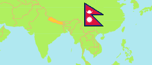
Humla
District in Nepal
Contents: Subdivision
The population development in Humla as well as related information and services (Wikipedia, Google, images).
| Name | Status | Transcription | Native | Population Census 2001-05-28 | Population Census 2011-06-22 | Population Census 2021-11-25 | |
|---|---|---|---|---|---|---|---|
| Humla | District | Humlā | हुम्ला जिल्ला | 40,595 | 50,858 | 55,394 | |
| Adanchuli | Rural Municipality | Adānaculī | अदानचुली गाउँपालिका | ... | 7,140 | 8,265 | → |
| Chankheli | Rural Municipality | Caṅkhēlī | चंखेली गाउँपालिका | ... | 5,541 | 6,579 | → |
| Kharpunath | Rural Municipality | Khārpunātha | खार्पुनाथ गाउँपालिका | 5,139 | 6,045 | 6,736 | → |
| Namkha | Rural Municipality | Nāmkhā | नाम्खा गाउँपालिका | ... | 4,250 | 3,589 | → |
| Sarkegad | Rural Municipality | Sarkēgāḍa | सर्केगाड गाउँपालिका | ... | 9,868 | 10,688 | → |
| Simkot | Rural Municipality | Simakōṭa | सिमकोट गाउँपालिका | ... | 12,038 | 11,935 | → |
| Tanjakot | Rural Municipality | Tā̃jākōṭa | ताँजाकोट गाउँपालिका | 4,280 | 5,976 | 6,092 | → |
| Nepal | Federal Republic | Nēpāla | नेपाल | 23,151,423 | 26,494,504 | 29,164,578 |
Source: Central Bureau of Statistics Nepal (web).
Explanation: The local units became operational in May 2017. The 2021 population of local units exclude institional population.
Further information about the population structure:
| Gender (C 2021) | |
|---|---|
| Males | 27,886 |
| Females | 27,508 |
| Age Groups (C 2021) | |
|---|---|
| 0-14 years | 20,000 |
| 15-64 years | 32,418 |
| 65+ years | 2,976 |
| Age Distribution (C 2021) | |
|---|---|
| 90+ years | 58 |
| 80-89 years | 289 |
| 70-79 years | 1,530 |
| 60-69 years | 2,853 |
| 50-59 years | 4,170 |
| 40-49 years | 5,295 |
| 30-39 years | 7,486 |
| 20-29 years | 8,432 |
| 10-19 years | 12,453 |
| 0-9 years | 12,828 |
| Citizenhip (C 2021) | |
|---|---|
| Nepal | 55,394 |
| Place of Birth (C 2021) | |
|---|---|
| Same local unit | 51,011 |
| Other local unit in same district | 2,447 |
| Other district | 1,890 |
| Other country | 18 |
| Literacy (A5+) (C 2021) | |
|---|---|
| Yes | 31,491 |
| Only reading | 286 |
| No | 17,490 |