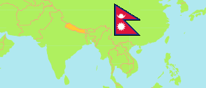
Myagdi
District in Nepal
Contents: Subdivision
The population development in Myagdi as well as related information and services (Wikipedia, Google, images).
| Name | Status | Transcription | Native | Population Census 2001-05-28 | Population Census 2011-06-22 | Population Census 2021-11-25 | |
|---|---|---|---|---|---|---|---|
| Myagdi | District | Myāgdī | म्याग्दी जिल्ला | 114,447 | 113,641 | 107,033 | |
| Annapurna | Rural Municipality | Annapurṇa | अन्नपुर्ण गाउँपालिका | ... | 13,337 | 12,323 | → |
| Beni | Municipality | Bēnī | बेनी नगरपालिका | ... | 34,878 | 32,697 | → |
| Dhaulagiri | Rural Municipality | Dhavalāgirī | धवलागिरी गाउँपालिका | 14,754 | 14,112 | 12,616 | → |
| Dhorpatan Hunting Reserve | Hunting Reserve | Ḍhōrapāṭana Śikāra Ārakṣa | ढोरपाटन शिकार आरक्ष | 0 | 0 | 0 | → |
| Malika | Rural Municipality | Mālikā | मालिका गाउँपालिका | ... | 19,208 | 18,332 | → |
| Mangala | Rural Municipality | Maṅgalā | मंगला गाउँपालिका | ... | 16,334 | 14,688 | → |
| Raghuganga | Rural Municipality | Raghugaṅgā | रघुगंगा गाउँपालिका | 17,984 | 15,772 | 14,114 | → |
| Nepal | Federal Republic | Nēpāla | नेपाल | 23,151,423 | 26,494,504 | 29,164,578 |
Source: Central Bureau of Statistics Nepal (web).
Explanation: The local units became operational in May 2017. The 2021 population of local units exclude institional population.
Further information about the population structure:
| Gender (C 2021) | |
|---|---|
| Males | 52,153 |
| Females | 54,880 |
| Age Groups (C 2021) | |
|---|---|
| 0-14 years | 27,583 |
| 15-64 years | 68,569 |
| 65+ years | 10,881 |
| Age Distribution (C 2021) | |
|---|---|
| 90+ years | 306 |
| 80-89 years | 1,740 |
| 70-79 years | 5,171 |
| 60-69 years | 8,057 |
| 50-59 years | 10,891 |
| 40-49 years | 11,360 |
| 30-39 years | 14,079 |
| 20-29 years | 17,899 |
| 10-19 years | 20,138 |
| 0-9 years | 17,392 |
| Citizenhip (C 2021) | |
|---|---|
| Nepal | 106,292 |
| India | 736 |
| Other Citizenship | 5 |
| Place of Birth (C 2021) | |
|---|---|
| Same local unit | 85,926 |
| Other local unit in same district | 11,552 |
| Other district | 8,171 |
| Other country | 1,211 |
| Literacy (A5+) (C 2021) | |
|---|---|
| Yes | 78,918 |
| Only reading | 422 |
| No | 19,531 |