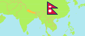
Bara
District in Nepal
Contents: Subdivision
The population development in Bara as well as related information and services (Wikipedia, Google, images).
| Name | Status | Transcription | Native | Population Census 2001-05-28 | Population Census 2011-06-22 | Population Census 2021-11-25 | |
|---|---|---|---|---|---|---|---|
| Bara | District | Bārā | बारा जिल्ला | 559,135 | 687,708 | 763,137 | |
| Adarsha Kotwal | Rural Municipality | Ādarśa Kōṭavāla | आदर्श कोटवाल गाउँपालिका | 21,590 | 27,552 | 31,364 | → |
| Baragadhi | Rural Municipality | Bārāgaḍhīgāũpālikā | बारागढीगाउँपालिका | ... | 27,191 | 29,555 | → |
| Bishrampur | Rural Municipality | Viśrāmapura | विश्रामपुर गाउँपालिका | 18,912 | 23,814 | 24,892 | → |
| Devtal | Rural Municipality | Dēvatāla | देवताल गाउँपालिका | ... | 23,011 | 25,361 | → |
| Jitpur Simara | Sub-Metropolis | Jītapura Simarā | जीतपुर सिमरा उपमहानगरपालिका | ... | 118,398 | 127,307 | → |
| Kalaiya | Sub-Metropolis | Kalaiyā | कलैया उपमहानगरपालिका | ... | 123,575 | 136,222 | → |
| Karaiyamai | Rural Municipality | Karaiyāmāī | करैयामाई गाउँपालिका | ... | 26,496 | 29,165 | → |
| Kolhabi | Municipality | Kōlhavī | कोल्हवी नगरपालिका | 40,213 | 44,082 | 51,182 | → |
| Mahagadhimai | Municipality | Mahāgaḍhīmāī | महागढीमाई नगरपालिका | ... | 52,396 | 59,424 | → |
| Nijgadh | Municipality | Nijagaḍha | निजगढ नगरपालिका | 30,693 | 35,403 | 37,687 | → |
| Pachrauta | Municipality | Pacarautā | पचरौता नगरपालिका | ... | 34,194 | 40,524 | → |
| Parawanipur | Rural Municipality | Paravānīpura | परवानीपुर गाउँपालिका | ... | 22,787 | 24,745 | → |
| Parsa Wildlife Reserve | Wildlife Reserve | Parsā Vanyajantu Ārakṣa | पर्सा वन्यजन्तु आरक्ष | 0 | 0 | 0 | → |
| Pheta | Rural Municipality | Phēṭā | फेटा गाउँपालिका | ... | 25,653 | 28,395 | → |
| Prasauni | Rural Municipality | Prasaunī | प्रसौनी गाउँपालिका | ... | 25,049 | 25,414 | → |
| Simraungadh | Municipality | Simraunagaḍha | सिम्रौनगढ नगरपालिका | ... | 48,570 | 54,878 | → |
| Suwarna | Rural Municipality | Suvarṇa | सुवर्ण गाउँपालिका | ... | 29,537 | 35,141 | → |
| Nepal | Federal Republic | Nēpāla | नेपाल | 23,151,423 | 26,494,504 | 29,164,578 |
Source: Central Bureau of Statistics Nepal (web).
Explanation: The local units became operational in May 2017. The 2021 population of local units exclude institional population.
Further information about the population structure:
| Gender (C 2021) | |
|---|---|
| Males | 389,787 |
| Females | 373,350 |
| Age Groups (C 2021) | |
|---|---|
| 0-14 years | 249,830 |
| 15-64 years | 468,937 |
| 65+ years | 44,370 |
| Age Distribution (C 2021) | |
|---|---|
| 90+ years | 840 |
| 80-89 years | 3,723 |
| 70-79 years | 22,144 |
| 60-69 years | 37,392 |
| 50-59 years | 54,035 |
| 40-49 years | 76,974 |
| 30-39 years | 104,549 |
| 20-29 years | 132,729 |
| 10-19 years | 166,625 |
| 0-9 years | 164,126 |
| Citizenhip (C 2021) | |
|---|---|
| Nepal | 758,311 |
| India | 4,812 |
| Other Citizenship | 14 |
| Place of Birth (C 2021) | |
|---|---|
| Same local unit | 604,018 |
| Other local unit in same district | 57,545 |
| Other district | 71,212 |
| Other country | 30,278 |
| Literacy (A5+) (C 2021) | |
|---|---|
| Yes | 442,431 |
| Only reading | 1,565 |
| No | 241,491 |