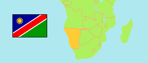
Zambezi
Region in Namibia
Contents: Subdivision
The population development in Zambezi as well as related information and services (Wikipedia, Google, images).
| Name | Status | Population Census 2011-08-28 | Population Census 2023-09-24 | |
|---|---|---|---|---|
| Zambezi (Caprivi) | Region | 90,596 | 142,373 | |
| Judea Lyaboloma | Constituency | 5,511 | 8,738 | → |
| Kabbe North | Constituency | 9,559 | 12,253 | → |
| Kabbe South | Constituency | 8,073 | 11,345 | → |
| Katima Mulilo Rural | Constituency | 13,285 | 24,016 | → |
| Katima Mulilo Urban | Constituency | 28,362 | 46,401 | → |
| Kongola | Constituency | 7,366 | 12,069 | → |
| Linyanti | Constituency | 7,328 | 10,425 | → |
| Sibbinda | Constituency | 11,112 | 17,126 | → |
| Namibia | Republic | 2,113,077 | 3,022,401 |
Source: Namibia Statistics Agency.
Explanation: Boundaries according to the 4th delimitation.
Further information about the population structure:
| Gender (C 2023) | |
|---|---|
| Males | 69,997 |
| Females | 72,376 |
| Age Groups (C 2011) | |
|---|---|
| 0-14 years | 35,346 |
| 15-64 years | 51,226 |
| 65+ years | 4,024 |
| Age Distribution (C 2011) | |
|---|---|
| 0-9 years | 23,963 |
| 10-19 years | 21,938 |
| 20-29 years | 16,836 |
| 30-39 years | 11,520 |
| 40-49 years | 6,982 |
| 50-59 years | 3,864 |
| 60-69 years | 2,584 |
| 70-79 years | 1,577 |
| 80+ years | 1,332 |