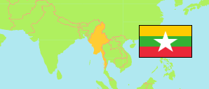
Sagaing
Region in Myanmar
Contents: Subdivision
The population development in Sagaing as well as related information and services (Wikipedia, Google, images).
| Name | Status | Native | Population Census 1983-03-31 | Population Census 2014-03-29 | Population Census 2024-09-30 | |
|---|---|---|---|---|---|---|
| Sagaing | Region | စစ်ကိုင်းတိုင်းဒေသကြီး | 3,721,989 | 5,325,347 | 5,977,292 | |
| Ayadaw | Township | အရာတော် | 143,481 | 155,769 | 187,067 | → |
| Banmauk | Township | ဗန်းမောက် | 61,418 | 112,668 | 99,870 | → |
| Budalin | Township | ဘုတလင် | 112,112 | 123,539 | 105,859 | → |
| Chaung-U | Township | ချောင်းဦး | 82,572 | 105,955 | 99,066 | → |
| Hkamti | Township | ခန္တီး | 24,025 | 47,658 | 41,413 | → |
| Homalin | Township | ဟုမ္မလင်း | 110,459 | 258,206 | 295,396 | → |
| Indaw | Township | အင်းတော် | 80,247 | 120,266 | 99,813 | → |
| Kale | Township | ကလေး | 187,401 | 348,573 | 537,413 | → |
| Kalewa | Township | ကလေးဝ | 42,847 | 56,432 | 66,021 | → |
| Kanbalu | Township | ကန့်ဘလူ | 182,997 | 295,561 | 315,564 | → |
| Kani | Township | ကနီ | 99,755 | 134,541 | 143,203 | → |
| Katha | Township | ကသာ | 94,550 | 167,734 | 267,797 | → |
| Kawlin | Township | ကောလင်း | 91,116 | 145,297 | 166,532 | → |
| Khin-U | Township | ခင်ဦး | 115,127 | 146,457 | 169,238 | → |
| Kyunhla | Township | ကျွန်းလှ | 51,767 | 104,087 | 96,914 | → |
| Lahe | Township | လဟယ် | 23,648 | 48,526 | 51,078 | → |
| Leshi | Township | လေရှီး | 11,968 | 16,322 | 16,508 | → |
| Mawlaik | Township | မော်လိုက် | 36,335 | 51,314 | 71,800 | → |
| Mingin | Township | မင်းကင်း | 75,977 | 104,363 | 99,790 | → |
| Monywa | Township | မုံရွာ | 242,451 | 372,095 | 259,077 | → |
| Myaung | Township | မြောင် | 107,967 | 106,411 | 108,132 | → |
| Myinmu | Township | မြင်းမူ | 97,361 | 106,986 | 117,722 | → |
| Nanyun | Township | နန်းယွန်း | 16,405 | 51,980 | 54,096 | → |
| Pale | Township | ပုလဲ | 107,752 | 144,006 | 190,119 | → |
| Paungbyin | Township | ဖောင်းပြင် | 71,988 | 112,694 | 139,881 | → |
| Pinlebu | Township | ပင်လည်ဘူး | 78,906 | 111,968 | 132,597 | → |
| Sagaing | Township | စစ်ကိုင်း | 233,506 | 307,194 | 296,305 | → |
| Salingyi | Township | ဆားလင်းကြီး | 105,233 | 121,808 | 121,231 | → |
| Shwebo | Township | ရွှေဘို | 206,142 | 266,807 | 384,811 | → |
| Tabayin | Township | ဒီပဲယင်း | 108,387 | 140,815 | 172,424 | → |
| Tamu | Township | တမူး | 57,074 | 114,869 | 106,127 | → |
| Taze | Township | တန့်ဆည် | 127,942 | 165,110 | 214,854 | → |
| Tigyaing | Township | ထီးချိုင့် | 72,923 | 129,955 | 158,252 | → |
| Wetlet | Township | ဝက်လက် | 171,042 | 196,216 | 229,717 | → |
| Wuntho | Township | ဝန်းသို | 48,445 | 73,395 | 70,232 | → |
| Ye-U | Township | ရေဦး | 101,236 | 118,290 | 150,700 | → |
| Yinmabin | Township | ယင်းမာပင် | 102,413 | 141,480 | 140,673 | → |
| Myanmar [Burma] | Republic | မြန်မာနိုင်ငံ | 35,307,913 | 51,486,253 | 51,375,327 |
Source: Myanmar Department of Population.
Explanation: The 1983 and 2014 figures of townships refer only to the enumerated population, which exclude an estimated population of 1,183,005 and 1,206,353, respectively. In case of large deviations or administrative reorganizations, no population values are tabulated. The 2024 population figures include an estimated population of 19,191,728. Area figures are calculated by geospatial data.