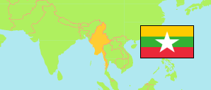
Hkamti
District in Myanmar
Contents: Subdivision
The population in Hkamti as well as related information and services (Wikipedia, Google, images).
| Name | Status | Population Census 2014-03-29 | |
|---|---|---|---|
| Hkamti | District | 422,692 | |
| Hkamti | Township | 47,658 | → |
| Homalin | Township | 258,206 | → |
| Lahe | Township | 48,526 | → |
| Leshi (Lay Shi) | Township | 16,322 | → |
| Nanyun | Township | 51,980 | → |
| Myanmar | Republic | 50,279,900 |
Source: The 2014 Myanmar Population and Housing Census - The Union Report, May 2015 (web).
Explanation: The enumerated population is tabulated. Townships include corresponding sub-townships. Area figures are calculated from geospatial data.