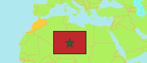
Bni Makada
Arrondissement in Tanger City
Contents: Population
The population development of Bni Makada as well as related information and services (Wikipedia, Google, images).
| Name | Status | Native | Population Census 1994-09-02 | Population Census 2004-09-02 | Population Census 2014-09-01 | Population Census 2024-09-01 | |
|---|---|---|---|---|---|---|---|
| Bni Makada | Arrondissement | بني مكادة | 144,154 | 238,382 | 386,191 | 567,465 | |
| Tanger | City | طنجة | 497,147 | 687,667 | 947,952 | 1,275,428 |
Source: Haut Commissariat au Plan, Royaume du Maroc.
Explanation: Area figures are calculated using geospatial data.
Further information about the population structure:
| Gender (C 2014) | |
|---|---|
| Males | 197,129 |
| Females | 188,793 |
| Age Groups (C 2014) | |
|---|---|
| 0-14 years | 110,301 |
| 15-64 years | 261,506 |
| 65+ years | 14,115 |
| Age Distribution (C 2014) | |
|---|---|
| 70+ years | 9,398 |
| 60-69 years | 13,676 |
| 50-59 years | 27,132 |
| 40-49 years | 40,272 |
| 30-39 years | 64,903 |
| 20-29 years | 86,028 |
| 10-19 years | 67,366 |
| 0-9 years | 77,147 |
| Urbanization (C 2024) | |
|---|---|
| Urban | 567,465 |
| Citizenship (C 2024) | |
|---|---|
| Morocco | 566,538 |
| Foreign Citizenship | 927 |