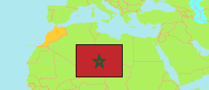
Morocco: Tanger City
Contents: Tanger
City
947,952 Population [2014] – census
1,275,428 Population [2024] – census
164.7km² Area
7,745/km² Density [2024]
Contents: Arrondissements
The population of the arrondissements of Tanger city by census years.
| Name | Status | Native | Population Census 1994-09-02 | Population Census 2004-09-02 | Population Census 2014-09-01 | Population Census 2024-09-01 | |
|---|---|---|---|---|---|---|---|
| Bni Makada | Arrondissement | بني مكادة | 144,154 | 238,382 | 386,191 | 567,465 | → |
| Mghogha | Arrondissement | الشرف مغوغة | 108,577 | 141,987 | 201,122 | 252,656 | → |
| Souani | Arrondissement | الشرف السواني | 105,882 | 115,839 | 117,557 | 111,772 | → |
| Tanger-Médina | Arrondissement | طنجة المدينة | 138,534 | 173,477 | 243,082 | 343,535 | → |
| Tanger | City | طنجة | 497,147 | 687,667 | 947,952 | 1,275,428 |
Source: Haut Commissariat au Plan, Royaume du Maroc.
Explanation: Area figures are calculated using geospatial data.
Further information about the population structure:
| Gender (C 2014) | |
|---|---|
| Males | 479,527 |
| Females | 464,290 |
| Age Groups (C 2014) | |
|---|---|
| 0-14 years | 247,672 |
| 15-64 years | 650,117 |
| 65+ years | 46,027 |
| Age Distribution (C 2014) | |
|---|---|
| 70+ years | 30,643 |
| 60-69 years | 42,089 |
| 50-59 years | 79,302 |
| 40-49 years | 108,609 |
| 30-39 years | 157,290 |
| 20-29 years | 199,861 |
| 10-19 years | 153,588 |
| 0-9 years | 172,434 |
| Urbanization (C 2024) | |
|---|---|
| Urban | 1,275,428 |
| Citizenship (C 2024) | |
|---|---|
| Morocco | 1,268,512 |
| Foreign Citizenship | 6,916 |