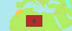
Sidi Ahmed Benaissa
Rural Commune in Rabat-Salé-Kénitra Region
Contents: Population
The population development of Sidi Ahmed Benaissa as well as related information and services (Wikipedia, Google, images).
| Name | Status | Native | Population Census 1994-09-02 | Population Census 2004-09-02 | Population Census 2014-09-01 | Population Census 2024-09-01 | |
|---|---|---|---|---|---|---|---|
| Sidi Ahmed Benaissa | Rural Commune | سيدي احمد بنعيسى | 9,248 | 8,901 | 7,810 | 7,685 | |
| Rabat - Salé - Kénitra | Region | الرباط - سلا - القنيطرة | 3,417,094 | 4,023,217 | 4,580,866 | 5,132,639 |
Source: Haut Commissariat au Plan, Royaume du Maroc.
Explanation: Area figures are calculated using geospatial data. Some population changes are due to boundary changes.
Further information about the population structure:
| Gender (C 2014) | |
|---|---|
| Males | 4,149 |
| Females | 3,661 |
| Age Groups (C 2014) | |
|---|---|
| 0-14 years | 2,579 |
| 15-64 years | 4,768 |
| 65+ years | 463 |
| Age Distribution (C 2014) | |
|---|---|
| 70+ years | 331 |
| 60-69 years | 389 |
| 50-59 years | 638 |
| 40-49 years | 682 |
| 30-39 years | 1,040 |
| 20-29 years | 1,382 |
| 10-19 years | 1,675 |
| 0-9 years | 1,673 |
| Urbanization (C 2024) | |
|---|---|
| Rural | 7,685 |
| Citizenship (C 2024) | |
|---|---|
| Morocco | 7,685 |