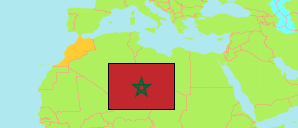
Agdal Riyad
Arrondissement in Rabat City
Contents: Population
The population development of Agdal Riyad as well as related information and services (Wikipedia, Google, images).
| Name | Status | Native | Population Census 1994-09-02 | Population Census 2004-09-02 | Population Census 2014-09-01 | Population Census 2024-09-01 | |
|---|---|---|---|---|---|---|---|
| Agdal Riyad | Arrondissement | أكدال الرياض | 74,006 | 90,568 | 77,257 | 70,435 | |
| Rabat | City | الرباط | 615,377 | 621,480 | 573,895 | 509,916 |
Source: Haut Commissariat au Plan, Royaume du Maroc.
Explanation: Area figures are calculated using geospatial data.
Further information about the population structure:
| Gender (C 2014) | |
|---|---|
| Males | 35,069 |
| Females | 38,911 |
| Age Groups (C 2014) | |
|---|---|
| 0-14 years | 14,692 |
| 15-64 years | 52,019 |
| 65+ years | 7,269 |
| Age Distribution (C 2014) | |
|---|---|
| 70+ years | 4,263 |
| 60-69 years | 7,651 |
| 50-59 years | 10,356 |
| 40-49 years | 10,713 |
| 30-39 years | 10,013 |
| 20-29 years | 10,953 |
| 10-19 years | 10,639 |
| 0-9 years | 9,392 |
| Urbanization (C 2024) | |
|---|---|
| Urban | 70,435 |
| Citizenship (C 2024) | |
|---|---|
| Morocco | 64,551 |
| Foreign Citizenship | 5,884 |