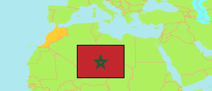
Morocco: Rabat City
Contents: Rabat
City
573,895 Population [2014] – census
509,916 Population [2024] – census
116.5km² Area
4,379/km² Density [2024]
Contents: Arrondissements
The population of the arrondissements of Rabat city by census years.
| Name | Status | Native | Population Census 1994-09-02 | Population Census 2004-09-02 | Population Census 2014-09-01 | Population Census 2024-09-01 | |
|---|---|---|---|---|---|---|---|
| Agdal Riyad | Arrondissement | أكدال الرياض | 74,006 | 90,568 | 77,257 | 70,435 | → |
| El Youssoufia | Arrondissement | اليوسفية | 170,138 | 172,863 | 170,561 | 157,587 | → |
| Hassan | Arrondissement | حسان | 146,488 | 128,425 | 108,179 | 92,454 | → |
| Souissi | Arrondissement | السويسي | 25,070 | 27,323 | 23,366 | 21,049 | → |
| Yacoub El Mansour | Arrondissement | يعقوب المنصور | 199,675 | 202,301 | 194,532 | 168,391 | → |
| Rabat | City | الرباط | 615,377 | 621,480 | 573,895 | 509,916 |
Source: Haut Commissariat au Plan, Royaume du Maroc.
Explanation: Area figures are calculated using geospatial data.
Further information about the population structure:
| Gender (C 2014) | |
|---|---|
| Males | 275,606 |
| Females | 293,179 |
| Age Groups (C 2014) | |
|---|---|
| 0-14 years | 117,540 |
| 15-64 years | 401,338 |
| 65+ years | 49,907 |
| Age Distribution (C 2014) | |
|---|---|
| 70+ years | 32,818 |
| 60-69 years | 44,587 |
| 50-59 years | 71,817 |
| 40-49 years | 82,326 |
| 30-39 years | 87,389 |
| 20-29 years | 91,384 |
| 10-19 years | 80,265 |
| 0-9 years | 78,199 |
| Urbanization (C 2024) | |
|---|---|
| Urban | 509,916 |
| Citizenship (C 2024) | |
|---|---|
| Morocco | 495,302 |
| Foreign Citizenship | 14,614 |