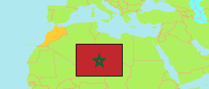
Marrakech
Prefecture in Marrakech-Safi Region
Contents: Subdivision
The population development in Marrakech as well as related information and services (Wikipedia, Google, images).
| Name | Status | Native | Population Census 1994-09-02 | Population Census 2004-09-02 | Population Census 2014-09-01 | Population Census 2024-09-01 | |
|---|---|---|---|---|---|---|---|
| Marrakech [Marrakesh] | Prefecture | مراكش | 861,205 | 1,070,838 | 1,330,468 | 1,571,580 | |
| Agafay | Rural Commune | اكفاي | 9,170 | 11,079 | 15,452 | 17,771 | → |
| Aït Imour | Rural Commune | أيت ايمور | 11,073 | 12,164 | 14,544 | 14,603 | → |
| Alouidane | Rural Commune | الويدان | 17,220 | 20,925 | 28,194 | 37,450 | → |
| Annakhil | Arrondissement | النخيل | 38,355 | 54,111 | 64,590 | 71,506 | → |
| Gueliz | Arrondissement | جليز | 148,305 | 173,101 | 192,774 | 219,863 | → |
| Harbil | Commune | حربيل | 13,209 | 17,007 | 51,881 | 105,790 | → |
| Loudaya | Commune | الأوداية | 22,247 | 26,999 | 33,767 | 41,761 | → |
| Marrakech-Médina | Arrondissement | مراكش المدينة | 192,323 | 167,233 | 120,643 | 81,103 | → |
| Méchouar-Kasba | Urban Commune | المشور-القصبة | 25,125 | 22,111 | 16,860 | 12,116 | → |
| Ménara | Arrondissement | المنارة | 148,403 | 281,663 | 411,094 | 522,259 | → |
| M'Nabha | Commune | المنابهة | 11,685 | 11,755 | 12,893 | 13,565 | → |
| Ouahat Sidi Brahim | Commune | واحة سيدي ابراهيم | 7,646 | 13,686 | 25,320 | 36,493 | → |
| Oulad Dlim | Rural Commune | أولاد دليم | 15,909 | 14,747 | 14,716 | 14,468 | → |
| Oulad Hassoune | Rural Commune | أولاد حسون | 16,573 | 19,188 | 23,475 | 27,314 | → |
| Saâda | Rural Commune | سعادة | 24,405 | 39,071 | 67,086 | 91,903 | → |
| Sidi Youssef Ben Ali | Arrondissement | سيدي يوسف بن علي | 116,532 | 124,935 | 122,889 | 107,966 | → |
| Sid Zouine | Commune | سيدي الزوين | 9,269 | 11,631 | 14,954 | 17,130 | → |
| Souihla | Rural Commune | السويهلة | 15,551 | 19,295 | 28,164 | 32,506 | → |
| Tassoultante | Rural Commune | تسلطانت | 18,205 | 30,137 | 71,172 | 106,013 | → |
| Marrakech - Safi | Region | مراكش - آسفي | 3,546,768 | 3,983,659 | 4,520,569 | 4,892,393 |
Source: Haut Commissariat au Plan, Royaume du Maroc.
Explanation: Area figures are calculated using geospatial data. Some population changes are due to boundary changes.
Further information about the population structure:
| Gender (C 2014) | |
|---|---|
| Males | 654,865 |
| Females | 668,140 |
| Age Groups (C 2014) | |
|---|---|
| 0-14 years | 365,091 |
| 15-64 years | 884,148 |
| 65+ years | 73,765 |
| Age Distribution (C 2014) | |
|---|---|
| 70+ years | 49,211 |
| 60-69 years | 70,787 |
| 50-59 years | 131,796 |
| 40-49 years | 168,448 |
| 30-39 years | 202,753 |
| 20-29 years | 225,132 |
| 10-19 years | 220,095 |
| 0-9 years | 254,782 |
| Urbanization (C 2024) | |
|---|---|
| Rural | 437,107 |
| Urban | 1,134,473 |
| Citizenship (C 2024) | |
|---|---|
| Morocco | 1,560,704 |
| Foreign Citizenship | 10,876 |