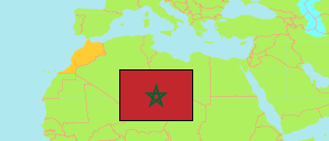
Sidi Haj M'hamed
Rural Commune in Fès-Meknès Region
Contents: Population
The population development of Sidi Haj M'hamed as well as related information and services (Wikipedia, Google, images).
| Name | Status | Native | Population Census 1994-09-02 | Population Census 2004-09-02 | Population Census 2014-09-01 | Population Census 2024-09-01 | |
|---|---|---|---|---|---|---|---|
| Sidi Haj M'hamed | Rural Commune | سيدي الحاج امحمد | 6,818 | 8,649 | 9,326 | 7,880 | |
| Fès - Meknès | Region | فاس - مكناس | 3,425,789 | 3,873,214 | 4,236,892 | 4,467,911 |
Source: Haut Commissariat au Plan, Royaume du Maroc.
Explanation: Area figures are calculated using geospatial data. Some population changes are due to boundary changes.
Further information about the population structure:
| Gender (C 2014) | |
|---|---|
| Males | 4,708 |
| Females | 4,618 |
| Age Groups (C 2014) | |
|---|---|
| 0-14 years | 3,174 |
| 15-64 years | 5,650 |
| 65+ years | 502 |
| Age Distribution (C 2014) | |
|---|---|
| 70+ years | 360 |
| 60-69 years | 385 |
| 50-59 years | 619 |
| 40-49 years | 914 |
| 30-39 years | 1,242 |
| 20-29 years | 1,676 |
| 10-19 years | 2,034 |
| 0-9 years | 2,096 |
| Urbanization (C 2024) | |
|---|---|
| Rural | 7,880 |
| Citizenship (C 2024) | |
|---|---|
| Morocco | 7,880 |