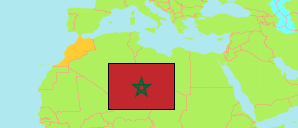
Boulemane
Province in Fès-Meknès Region
Contents: Subdivision
The population development in Boulemane as well as related information and services (Wikipedia, Google, images).
| Name | Status | Native | Population Census 1994-09-02 | Population Census 2004-09-02 | Population Census 2014-09-01 | Population Census 2024-09-01 | |
|---|---|---|---|---|---|---|---|
| Boulemane | Province | بولمان | 161,622 | 185,110 | 197,596 | 205,411 | |
| Aït Bazza | Rural Commune | أيت بازة | 3,580 | 3,480 | 2,955 | 2,397 | → |
| Aït El Mane | Rural Commune | أيت المان | 2,779 | 2,243 | 1,927 | 1,694 | → |
| Almis Marmoucha | Rural Commune | الميس مرموشة | 2,689 | 2,698 | 2,461 | 2,292 | → |
| Boulemane | Urban Commune | بولمان | 6,067 | 6,910 | 7,104 | 6,761 | → |
| El Mers | Rural Commune | المرس | 6,050 | 5,891 | 5,152 | 4,887 | → |
| El Orjane | Rural Commune | العرجان | 6,269 | 7,609 | 7,740 | 7,706 | → |
| Enjil | Rural Commune | انجيل | 7,684 | 8,164 | 8,364 | 7,984 | → |
| Ermila | Rural Commune | الرميلة | 6,574 | 6,774 | 7,690 | 8,333 | → |
| Fritissa | Rural Commune | افريطيسة | 24,279 | 26,022 | 29,460 | 29,594 | → |
| Guigou | Commune | كيكو | 16,249 | 19,035 | 21,607 | 24,677 | → |
| Imouzzer Marmoucha | Urban Commune | ايموزار مرموشة | 2,502 | 4,001 | 4,213 | 4,676 | → |
| Ksabi-Moulouya | Rural Commune | القصابي ملوية | 9,178 | 10,067 | 10,614 | 10,471 | → |
| Missour | Urban Commune | ميسور | 12,777 | 20,978 | 25,584 | 28,408 | → |
| Ouizeght | Rural Commune | ويزغت | 4,928 | 5,509 | 5,743 | 5,430 | → |
| Oulad Ali Youssef | Rural Commune | أولاد علي يوسف | 7,813 | 6,669 | 5,212 | 3,279 | → |
| Outat El Haj | Urban Commune | أوطاط الحاج | 9,987 | 13,945 | 16,388 | 20,673 | → |
| Serghina | Rural Commune | سرغينة | 3,780 | 3,726 | 3,746 | 3,567 | → |
| Sidi Boutayeb | Rural Commune | سيدي بوطيب | 8,924 | 9,522 | 9,823 | 9,969 | → |
| Skoura M'Daz | Commune | سكورة مداز | 8,011 | 8,713 | 8,462 | 8,297 | → |
| Talzemt | Rural Commune | تالزمت | 4,307 | 3,710 | 3,160 | 2,701 | → |
| Tissaf | Rural Commune | تيساف | 7,195 | 9,444 | 10,191 | 11,615 | → |
| Fès - Meknès | Region | فاس - مكناس | 3,425,789 | 3,873,214 | 4,236,892 | 4,467,911 |
Source: Haut Commissariat au Plan, Royaume du Maroc.
Explanation: Area figures are calculated using geospatial data. Some population changes are due to boundary changes.
Further information about the population structure:
| Gender (C 2014) | |
|---|---|
| Males | 97,324 |
| Females | 100,151 |
| Age Groups (C 2014) | |
|---|---|
| 0-14 years | 61,063 |
| 15-64 years | 123,415 |
| 65+ years | 12,997 |
| Age Distribution (C 2014) | |
|---|---|
| 70+ years | 9,203 |
| 60-69 years | 10,177 |
| 50-59 years | 16,037 |
| 40-49 years | 21,545 |
| 30-39 years | 27,532 |
| 20-29 years | 32,862 |
| 10-19 years | 39,129 |
| 0-9 years | 40,990 |
| Urbanization (C 2024) | |
|---|---|
| Rural | 129,348 |
| Urban | 76,063 |
| Citizenship (C 2024) | |
|---|---|
| Morocco | 205,377 |
| Foreign Citizenship | 34 |