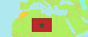
Errachidia
Province in Drâa-Tafilalet Region
Contents: Subdivision
The population development in Errachidia as well as related information and services (Wikipedia, Google, images).
| Name | Status | Native | Population Census 1994-09-02 | Population Census 2004-09-02 | Population Census 2014-09-01 | Population Census 2024-09-01 | |
|---|---|---|---|---|---|---|---|
| Errachidia | Province | الرشيدية | 376,414 | 396,531 | 418,451 | 427,572 | |
| Aarab Sebbah Gheris | Rural Commune | عرب صباح اغريس | 5,060 | 4,937 | 4,397 | 4,758 | → |
| Aarab Sebbah Ziz | Rural Commune | عرب صباح زيز | 18,522 | 18,332 | 19,192 | 20,538 | → |
| Aghbalou-N'kerdous | Rural Commune | اغبالو انكردوس | 8,249 | 9,357 | 10,313 | 10,675 | → |
| Amellagou | Rural Commune | املاكو | 5,090 | 5,273 | 4,975 | 4,711 | → |
| Aoufous | Commune | اوفوس | 12,946 | 11,506 | 10,424 | 8,888 | → |
| Arfoud | Urban Commune | ارفود | 18,563 | 23,637 | 29,279 | 28,912 | → |
| Bni M'Hamed-Sijelmassa | Rural Commune | بني امحمد سجلماسة | 22,600 | 16,709 | 14,433 | 11,925 | → |
| Boudnib | Urban Commune | بوذنيب | 8,294 | 9,867 | 11,373 | 13,411 | → |
| Chorfa M'Daghra | Rural Commune | شرفاء مدغرة | 12,207 | 13,803 | 14,312 | 18,171 | → |
| Errachidia | Urban Commune | الرشيدية | 62,542 | 76,759 | 92,374 | 97,687 | → |
| Er-rissani | Rural Commune | الريصاني | 4,673 | 5,575 | 5,010 | 4,353 | → |
| Er-rteb | Rural Commune | الرتب | 12,131 | 13,324 | 13,461 | 12,852 | → |
| Es-sfalat | Rural Commune | السفلات | 22,258 | 16,163 | 11,483 | 8,586 | → |
| Es-sifa | Rural Commune | السيفا | 9,159 | 7,881 | 7,035 | 6,531 | → |
| Et-taous | Rural Commune | الطاوس | 4,666 | 5,337 | 6,792 | 9,360 | → |
| Ferkla El Oulia | Rural Commune | فركلة العليا | 18,889 | 20,214 | 22,722 | 23,449 | → |
| Ferkla Es-soufla | Rural Commune | فركلة السفلى | 12,653 | 12,624 | 12,335 | 11,886 | → |
| Fezna | Rural Commune | فزنا | 4,120 | 4,087 | 4,477 | 4,400 | → |
| Gheris El Ouloui | Rural Commune | اغريس العلوي | 10,958 | 11,879 | 12,043 | 12,193 | → |
| Gheris Es-soufli | Rural Commune | اغريس السفلي | 6,521 | 6,742 | 6,867 | 6,877 | → |
| Goulmima | Urban Commune | كلميمة | 14,026 | 16,593 | 16,419 | 14,624 | → |
| Jorf | Urban Commune | الجرف | 12,143 | 12,135 | 12,302 | 11,865 | → |
| Lkheng | Rural Commune | الخنك | 13,075 | 13,017 | 14,177 | 18,381 | → |
| Melaab | Rural Commune | ملعب | 14,604 | 16,681 | 17,360 | 17,230 | → |
| Moulay Ali Cherif | Urban Commune | مولاي علي الشريف | 18,450 | 20,469 | 22,209 | 22,082 | → |
| Oued Naam | Rural Commune | وادي النعام | 6,729 | 5,709 | 5,340 | 5,708 | → |
| Sidi Ali | Rural Commune | سيدي علي | 3,572 | 3,081 | 2,162 | 1,973 | → |
| Tadighoust | Rural Commune | تاديغوست | 7,959 | 7,346 | 6,243 | 6,018 | → |
| Tinejdad | Urban Commune | تنجداد | 5,755 | 7,494 | 8,942 | 9,528 | → |
| Drâa - Tafilalet | Region | درعة - تافيلالت | 1,349,881 | 1,493,595 | 1,635,008 | 1,655,623 |
Source: Haut Commissariat au Plan, Royaume du Maroc.
Explanation: Area figures are calculated using geospatial data. Some population changes are due to boundary changes.
Further information about the population structure:
| Gender (C 2014) | |
|---|---|
| Males | 204,259 |
| Females | 211,704 |
| Age Groups (C 2014) | |
|---|---|
| 0-14 years | 127,478 |
| 15-64 years | 263,305 |
| 65+ years | 25,180 |
| Age Distribution (C 2014) | |
|---|---|
| 70+ years | 17,385 |
| 60-69 years | 20,947 |
| 50-59 years | 34,383 |
| 40-49 years | 45,073 |
| 30-39 years | 59,385 |
| 20-29 years | 70,821 |
| 10-19 years | 80,603 |
| 0-9 years | 87,366 |
| Urbanization (C 2024) | |
|---|---|
| Rural | 228,382 |
| Urban | 199,190 |
| Citizenship (C 2024) | |
|---|---|
| Morocco | 427,309 |
| Foreign Citizenship | 263 |