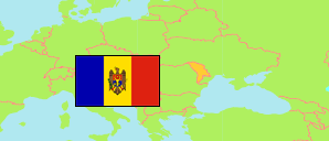
Moldova: Transnistria (Pridnestrovie)
Contents: Pridnestrovie
Moldavian Republic
475,007 Population [2015] – census
463,582 Population [2022] – estimate
3,530km² Area
131.3/km² Density [2022]
Contents: Districts
The population of the districts and district-level communes in Transnistria according to census results and estimates.
| Name | Status | Native | Population Census 1989-01-12 | Population Census 2004-11-11 | Population Census 2015-10-14 | Population Estimate 2022-01-01 | |
|---|---|---|---|---|---|---|---|
| Bendery [Bender, Tighina] | Commune | Бендеры | 139,463 | 105,010 | 91,197 | 88,628 | → |
| Dubossary [Dubăsari] | District | Дубоссары | 47,757 | 37,449 | 31,159 | 30,464 | → |
| Grigoriopol' | District | Григориополь | 53,128 | 48,000 | 39,795 | 38,293 | → |
| Kamenka [Camenca] | District | Каменка | 34,635 | 27,284 | 20,542 | 18,854 | → |
| Rybnica [Rybnitsa, Rîbnița] | District | Рыбница | 95,810 | 82,699 | 69,405 | 66,280 | → |
| Slobodzeja [Slobozia] | District | Слободзея | 110,138 | 95,742 | 83,798 | 82,448 | → |
| Tiraspol' | Commune | Тирасполь | 199,940 | 159,163 | 139,111 | 138,615 | → |
| Pridnestrovie [Transnistria] | Moldavian Republic | Приднестро́вье | 680,871 | 555,347 | 475,007 | 463,582 |
Source: State Statistics Service of Pridnestrovie, pop-stat.mashke.org, М.П. Бурла, А.В. Кривенко, В.Г. Фоменко: Динамика численности населения Приднестровья (1990–2015 гг.).
Explanation: Area figures are derived from geospatial data. Transnistria is not under control of the central government of Moldova.
Further information about the population structure:
| Gender (C 2004) | |
|---|---|
| Males | 255,668 |
| Females | 299,679 |
| Urbanization (E 2014) | |
|---|---|
| Rural | 155,926 |
| Urban | 349,227 |
| Ethnic Group (C 2004) | |
|---|---|
| Moldovans | 177,382 |
| Russians | 168,678 |
| Ukrainians | 160,069 |
| Bulgarians | 13,858 |
| Other ethnic groups | 18,161 |