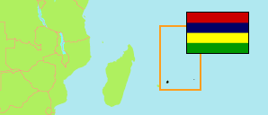
Verdun
Village Council Area in Mauritius Island
Contents: Population
The population development in Verdun as well as related information and services (Wikipedia, Google, images).
| Name | Status | Population Census 2000-07-02 | Population Census 2011-07-03 | Population Census 2022-07-03 | |
|---|---|---|---|---|---|
| Verdun | Village Council Area | 2,069 | 2,181 | 2,175 | |
| Mauritius | Island | 1,143,069 | 1,196,383 | 1,189,493 |
Source: Central Statistical Office of Mauritius.
Explanation: Area figures are computed by using geospatial data.
Further information about the population structure:
| Gender (C 2022) | |
|---|---|
| Males | 1,054 |
| Females | 1,121 |
| Age Groups (C 2022) | |
|---|---|
| 0-14 years | 296 |
| 15-64 years | 1,559 |
| 65+ years | 320 |
| Age Distribution (C 2022) | |
|---|---|
| 70+ years | 206 |
| 60-69 years | 254 |
| 50-59 years | 267 |
| 40-49 years | 346 |
| 30-39 years | 339 |
| 20-29 years | 322 |
| 10-19 years | 257 |
| 0-9 years | 184 |
| Urbanization (C 2022) | |
|---|---|
| Rural | 2,175 |
| Language at Home (C 2022) | |
|---|---|
| Creole | 1,774 |
| French | 24 |
| English | 12 |
| Bhojpuri | 163 |
| Bengali | 51 |
| Hindi | 142 |
| Other language | 9 |
| Religion (C 2022) | |
|---|---|
| Hindus | 1,409 |
| Muslims | 161 |
| Roman Catholics | 438 |
| Other Christians | 145 |
| Other/no religion | 22 |