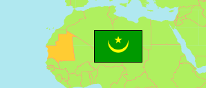
Assaba
Region in Mauritania
Contents: Subdivision
The population development in Assaba as well as related information and services (Wikipedia, Google, images).
| Name | Status | Native | Population Census 2000-11-01 | Population Census 2013-03-25 | Population Census 2023-12-25 | |
|---|---|---|---|---|---|---|
| Assaba | Region | العصابة | 242,265 | 325,897 | 451,804 | |
| Barkewol | Department | باركيول | 62,238 | 79,901 | 109,237 | → |
| Boumdeid | Department | بومديد | 8,704 | 7,917 | 10,747 | → |
| Guerou | Department | كرو | 31,480 | 44,870 | 67,964 | → |
| Kankossa | Department | كنكوصة | 63,064 | 82,495 | 117,392 | → |
| Kiffa | Department | كيفه | 76,779 | 110,714 | 146,464 | → |
| Mauritanie [Mauritania] | Islamic Republic | موريتانيا | 2,508,159 | 3,537,368 | 4,927,532 |
Source: Agence Nationale de la Statistique, de l’Analyse Démographique et Economique, Mauretanie.
Further information about the population structure:
| Gender (C 2023) | |
|---|---|
| Males | 203,189 |
| Females | 248,615 |
| Age Groups (C 2023) | |
|---|---|
| 0-14 years | 210,601 |
| 15-64 years | 220,793 |
| 65+ years | 20,410 |
| Age Distribution (C 2023) | |
|---|---|
| 0-9 years | 144,076 |
| 10-19 years | 119,541 |
| 20-29 years | 59,854 |
| 30-39 years | 43,298 |
| 40-49 years | 30,101 |
| 50-59 years | 24,841 |
| 60-69 years | 17,208 |
| 70-79 years | 7,919 |
| 80+ years | 4,966 |
| Urbanization (C 2023) | |
|---|---|
| Rural | 301,860 |
| Nomads | 1,706 |
| Urban | 148,238 |