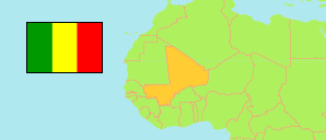
Mopti
Cercle in Mali
Contents: Subdivision
The population development in Mopti as well as related information and services (Wikipedia, Google, images).
| Name | Status | Population Census 1998-04-17 | Population Census 2009-04-01 | |
|---|---|---|---|---|
| Mopti | Cercle | 263,719 | 368,905 | |
| Bassirou | Commune | 1,369 | 1,718 | → |
| Borondougou | Commune | 7,234 | 8,070 | → |
| Dialloubé | Commune | 20,704 | 30,948 | → |
| Fatoma | Commune | 11,452 | 14,910 | → |
| Konna | Commune | 26,727 | 36,790 | → |
| Korombana | Commune | 19,213 | 29,741 | → |
| Koubaye | Commune | 5,013 | 6,571 | → |
| Kounari | Commune | 12,654 | 15,487 | → |
| Mopti | Urban Commune | 80,472 | 120,786 | → |
| Ouro Modi | Commune | 3,149 | 3,328 | → |
| Ouroubé Douddé | Commune | 10,573 | 12,224 | → |
| Sasalbé | Commune | 4,802 | 5,996 | → |
| Sio | Commune | 18,382 | 24,130 | → |
| Socoura | Commune | 24,254 | 36,983 | → |
| Soye | Commune | 17,721 | 21,223 | → |
| Mali | Republic | 9,810,912 | 14,528,662 |
Source: Institut National de la Statistiques, République du Mali (web).
Explanation: In case of the 1998 census, persons assigned to no commune are included in the cercle figures.